It was clear, early on, that Friday had a significant chance for severe weather. I was concerned that the computer models downplayed it somewhat. But Thursday, within a few hours of being run, they had already blown the forecast in Michigan… so the computers weren’t to be totally trusted.
A little activity started on Central New York State toward early afternoon and the Storm Prediction Center threw up a Severe Thunderstorm Watch for the entire state, effective until 8:00 PM.
That was the right call.
A little background. I forecast the weather. The folks I work with forecast the weather. My competitors forecast the weather. But, we all leave watches and warnings to the Weather Service. The idea is to present a coordinated front, so as not to be confusing. In my 20+ years in weather I have heard few dissent from this concept.
After a watch is posted, it is the job of the Taunton, MA National Weather Service Office to put out a ‘redefining’ statement for all of Connecticut (even though they normally only forecast for 3 of the 4 northern counties and none of the shoreline). These are needed because watches are parallelograms and they don’t evenly fit within state or county borders. Without the redefinition, a watch area might include a small sliver of a state or something else equally confusing.
Taunton’s original statement only included their counties.
WWUS61 KBOX 221719
SLSMA
WATCH COUNTY NOTIFICATION FOR WATCH #880
NATIONAL WEATHER SERVICE TAUNTON MA
120 PM EDT FRI AUG 22 2003
CTC003-013-015-MAC005-009-011-013-015-017-021-023-025-027-NHC005-011-
RIC001-003-005-007-009-230000-
THE NATIONAL WEATHER SERVICE HAS ISSUED SEVERE THUNDERSTORM WATCH
#880 UNTIL 800 PM EDT FRIDAY EVENING FOR THE FOLLOWING AREAS:
IN CONNECTICUT THIS WATCH INCLUDES 3 COUNTIES…
IN NORTHERN CONNECTICUT:
HARTFORD TOLLAND WINDHAM
Then a correction to include the whole state.
WWUS61 KBOX 221744 CCA
SLSMA
BULLETIN – IMMEDIATE BROADCAST REQUESTED
AREAL OUTLINE FOR SEVERE THUNDERSTORM WATCH NUMBER 880
NATIONAL WEATHER SERVICE TAUNTON MA …CORRECTION
143 PM EDT FRI AUG 22 2003
SEVERE THUNDERSTORM WATCH NUMBER 880 IN EFFECT UNTIL 800 PM EDT.
CTC001-003-005-007-009-011-013-015-230000-
IN CONNECTICUT THIS WATCH INCLUDES 8 COUNTIES
FAIRFIELD HARTFORD LITCHFIELD MIDDLESEX
NEW HAVEN NEW LONDON TOLLAND WINDHAM
ADJACENT COASTAL WATERS
But, by then the damage had been done. At the TV station our Weather Warn II computer was confused. It put up a Thunderstorm Watch and then alternated text for a “defined area” and mentioned the three original counties. If we would have aired it, it would have looked like the watch was only for three counties.
As I drove in, Kirk Varner, our news director (who reads this, I can’t blast him here), saw what was going on and basically shifted to manual. This system is supposed to work on its own, without intervention. At the moment, it can’t be trusted. But, thankfully, we had the right info on the screen.
Throughout the afternoon we saw scattered thunderstorms. They probably didn’t get to the ‘official’ severe limit, but were close enough to justify the watch box.
Thursday night, this same system had quieted down and then, with the watches expired, fired up. It even spawned tornadoes in Michigan on the ‘rebound.’
Tonight, the system again died down. And then a series of awful human judgment errors.
At 7:10 PM:
CTZ002>004-MAZ002>021-026-NHZ011-012-015-RIZ001>008-230000-
SPECIAL WEATHER STATEMENT
NATIONAL WEATHER SERVICE TAUNTON MA
710 PM EDT FRI AUG 22 2003
…PART OF THE SEVERE THUNDERSTORM WATCH IS NO LONGER IN EFFECT…
THE WATCH IS NO LONGER IN EFFECT FOR SOUTHWEST NEW HAMPSHIRE…
WESTERN…CENTRAL AND NORTHEAST MASSACHUSETTS…OR NORTHERN
CONNECTICUT. THUNDERSTORMS HAVE MOVED EAST OF THESE AREAS AND THE
THREAT OF SEVERE WEATHER HAS ENDED.
THE SEVERE THUNDERSTORM WATCH CONTINUES UNTIL 8 PM FOR RHODE ISLAND.
IT ALSO CONTINUES FOR SUFFOLK…NORFOLK…BRISTOL AND PLYMOUTH
COUNTIES IN EASTERN MASSACHUSETTS.
But, the threat hadn’t ended. All of a sudden, in Southern Windham County, the storms fired up rapidly and ferociously.
CTC015-RIC003-230015-
BULLETIN – EAS ACTIVATION REQUESTED
SEVERE THUNDERSTORM WARNING
NATIONAL WEATHER SERVICE TAUNTON MA
751 PM EDT FRI AUG 22 2003
THE NATIONAL WEATHER SERVICE IN TAUNTON HAS ISSUED A
* SEVERE THUNDERSTORM WARNING FOR…
WESTERN KENT COUNTY IN RHODE ISLAND
SOUTHEASTERN WINDHAM COUNTY IN NORTHERN CONNECTICUT
INCLUDING PLAINFIELD
* UNTIL 815 PM.
* AT 747 PM…NATIONAL WEATHER SERVICE DOPPLER RADAR INDICATED A
SEVERE THUNDERSTORM OVER PLAINFIELD…MOVING EAST AT 25 MPH.
* THE SEVERE THUNDERSTORM WILL BE NEAR…
COVENTRY AROUND 810 PM
WEST GREENWICH AROUND 815 PM.
SEVERE THUNDERSTORMS PRODUCE LARGE HAIL AND/OR WIND STRONG ENOUGH TO
KNOCK DOWN TREES AND POWER LINES. MOVE INDOORS AND STAY AWAY FROM
WINDOWS.
But, in Connecticut, these storms weren’t just over Windham County. They had crossed the border to New London County. In fact, by the time the warning went up, Northern New London County was seeing more action than Windham.
Windham County gets its warnings from Taunton, MA. New London County gets them from Upton, NY. No warning went up for New London County.
If there was reason for warning Windham County, there was reason for a warning to be issued for New London. This lack of coordination is a problem we face a few times a year, at the least.
At 7:51 PM, the watch and warning configuration in Connecticut was out of whack with what was actually happening. This system is supposed prepare and inform. It was confusing.
Thunderstorms continued, though weaker, until sometime past 10:00. Saturday will be a totally different weather animal – cooler and fresher.
I am not happy with what went on Friday. In many ways, I am powerless to change things unless I start ‘buying out’ of the unified watch and warning scenario.
I don’t think I’m ready for that… but I’m close.
——-
By the way, at 4:21 PM the dew point a Meriden, CT (KMMK) reached an unbelievable 79°! I can’t ever remember seeing a dew point that high in Connecticut.
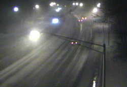
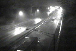
 Earlier tonight I took a quick look at one of the CT DOT traffic cameras on I-95 and gasped. The camera was in Greenwich-adjacent to the New York State line. While the rest of Connecticut was seeing moderate to heavy rain with temperatures mostly in the 40°s Greenwich had limited visibility with heavy snow. The snow had begun to accumulate!
 A few miles up the road in Stamford there was nothing but rain! Even now, hours later, only the communities in Lower Fairfield are seeing the snow stick.
 The barometer is so low it’s approaching the range usually seen in hurricanes and tropical storms. We get pressure readings this low every decade or so.

 A few weeks ago, I was asked to emcee an event at the Garde Arts Center in New London. It was the
  It’s an older theater – in this case a former vaudeville theater built in 1926. It has been lovingly restored to its former beauty and is now run as a non-profit; featuring plays, performance and what are commonly known as cultural events (though those two words will never help them sell a ticket).
 Asbury’s stock in trade are short films. They’re the kind of thing you hear about at the Oscar’s, when an award is given out, but never hear of again. Unlike a ‘real’ film festival, these shorts have been chosen over time. They represent a mix much less eclectic and more mainstream than what you’d see at a ‘standalone’ festival featuring all new work.
 Though short, the films are well shot with excellent production values. The scripts were good. In many ways a movie benefits from not being two hours long!