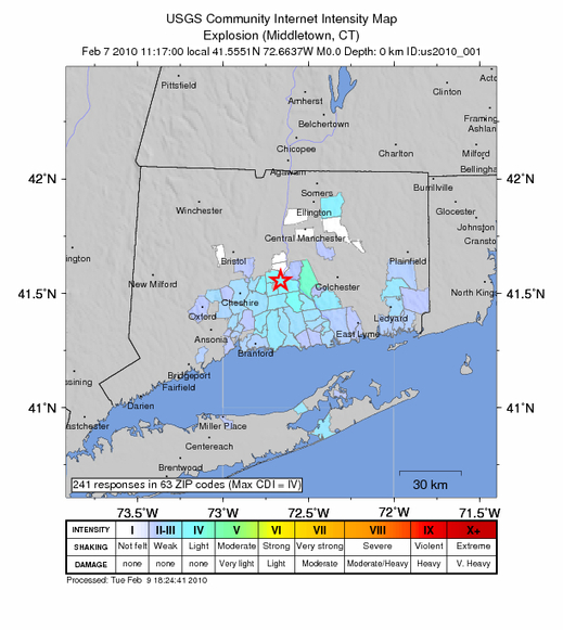
The USGS has plotted reports from the Kleen Energy explosion in Middletown. Though not an earthquake the standard quake methodology was use for creating the map. I’ve never gone through the reporting process before, but was impressed with the questionnaire on which the estimates are based.
Any reason given why it was mostly to the south of Middletown?