Too Much Tracking

This anal retentive ability to track a package should be satisfying, yet I’m always wondering why it’s stopped?

“Are you calling from the cockpit?” Those were the exact words from a friend as I called from the car a few days ago. My little car is noisy and my Bluetooth headset doesn’t help–actually it makes things worse.

I broke down last week and bought a model known for its noise canceling acumen. It’s a somewhat obscure brand and not available locally. I ordered online.

Like every other purchase nowadays I received a tracking number. I have tracked it a dozen or more times since last Thursday. Tonto wasn’t as dedicated a tracker as I am! It’s currently “out for delivery.”

This anal retentive ability to track a package should be satisfying, yet I’m always wondering why it’s stopped? Why isn’t it moving? What’s taking so long? Often billing information is received long before the package!

Google Maps (another refuge for the impatient) says the first leg is a 14:33 drive. What happened in the three plus days from “Departure Scan” to “Arrival Scan?” I suspect it really didn’t depart, but waited over the weekend.

It’s certainly possible we’ll be getting GPS based tracking before long. As soon as one company adds it they’ll all have to follow.

My point is, maybe we (and by “we” I mean “I”) would be better without access to yet another tool allowing me to overload with information.

Wadsworth Falls – Lucky Find

It is a beautiful place and totally unexpected. Twenty four years in Connecticut, I’d never heard of it!

wadsworth_falls_HDR2.jpg

While Stef and my mom did girl things, and Helaine prepared for another guest tonight, I set out with my dad for more picture taking. Originally I thought we’d go to Campbell Falls in Norfolk, CT. It’s nearly an hour and a half away and as time drew closer it seemed farther. I spent part of last night looking for ideas online and came up with Wadsworth Falls in the Rockfall section of Middlefield. It’s around a half hour from here.

We headed out, guided by the GPS. I didn’t bother to check the routing, which wasn’t what a local would have chosen. It didn’t make any difference. We made it there close to schedule.

Wadsworth Falls is a small state park. There is a nice size parking area and then a short walk downhill to the base of the falls. My dad, nearly 83, had no trouble with the walk. There is excellent access for photography, though the rocky path for a closer view was a little too slippery for my dad. He was not disappointed.

There was a couple there when we arrived, but they soon left leaving the waterfall to us alone. It is a beautiful place and totally unexpected. Twenty four years in Connecticut, I’d never heard of it!

What a find!

A Day On The River With My Dad

I had hoped for a day that could be characterized by a scene like that. God, I hope that last sentence makes sense.

I’m tired. Long day. Lots accomplished. This crap about vacations being for resting… I don’t think so.

Stef was babysitting this morning. That put her afternoon shopping with my mom on hold, which left enough time for Helaine and me to hoof it to the top of Sleeping Giant. I expected this week would be sans walking. Wrong.

And I claim to predict the future for a living! What a scam.

Back–oatmeal–shower. Stef takes my mom and drives off. This leaves Helaine, my dad and me in the house. I had a plan. I asked my dad if he wanted to take a drive to take some photos? I knew the answer before I popped the question.

Have I mentioned I predict the future for a living? I’m pretty good at it.

We hopped in the car and headed toward Chester. The top was down on this sunny afternoon. This whole trip was a leap of faith. I programmed our destination and blindly followed the disembodied GPS voice toward the Chester/Hadlyme ferry slip.

My folks lived in Connecticut for fourteen years before moving to Florida, but I guarantee this ferry (and its sister that runs between Rocky Hill and Glastonbury) was totally off their radar.

My goal was simple–get access to the Connecticut River. Is there a better way to see it than crossing it in a boat? Actually, calling this ferry a boat is a stretch. I’m not sure how to describe it, except to say “small.” The web write-ups consistently say it takes 8 or 9 cars. Yes, but with a shoehorn.

We timed it perfectly, getting to the slip as the ferry was halfway to the other side. That gave us time to get out of the car and take some shots.

As I approached the ramp, a canoe glided by. A woman in a two piece was paddling as a large black dog stood watch in the front. I had hoped for a day that could be characterized by a scene like that. God, I hope that last sentence makes sense.

“The present ferry, the Selden III,was built in 1949. It is an open, self-propelled craft, 65 feet long and 30 feet wide. The vessel can accommodate 8 to 9 cars and 49 passengers. The Selden III provides a convenient, direct link between Chester and Hadlyme at Route 148.” – CT DOT

I definitely recommend the ferry over the free bridge a few miles upriver. The ferry toll is $3 for a car and passengers, but it’s a piece of heaven. About &#190 of the way across the deckmate looked up and told the handful of passengers there was an eagle overhead. Holy crap, there was!

Making it to the Hadlyme side was all I had planned for the day, but it was still early. I asked my dad if he wanted to visit Gillette Castle? It became our next stop.

William Gillette was a stage actor, born in the 1850s. His specialty was Sherlock Holmes. Born too soon for the movies (he has a few picture credits from the 1910s), he still did very well financially. Gillette Castle was his estate, overlooking the Connecticut River at East Haddam.

I visited the castle when I was a little kid and the fear induced by seeing this very weird residence (now a state park) is still with me! I felt sorry for the young kids being dragged in by their parents. They will not sleep well tonight.

“Gillette Castle, built at a cost of about $1 million and completed in 1919, features a number of peculiarities including hidden mirrors, a lock-protected bar and intricate, hand-carved door latches on each of the castle’s 47 doors–no two are alike.” – About.com

I have more of an appreciation of Gillette’s home today. The outside is still strange to see, but inside is now more understandable.

It was hot today, so as I explored the home, my dad stayed downstairs. I can’t say enough about the Castle staff who brought him a chair and made sure he was comfortable. Then they let me backtrack (wrong way on the one-way stairs) to rejoin him when I was done.

We got back to the car and I punched the GPS screen a few more times, programming in our next destination. It wasn’t long before we were at the Goodspeed Opera House. As strange as it is to say, this theater in the middle-of-nowhere has an astounding history of spawning Broadway hits, including Annie!

Talk about spooky looking buildings!

The Victorian inspired theater sits on the river too, but at a much lower elevation than Gillette Castle. Unfortunately, there wasn’t the easy foot access we had there either. I went out and took a few pictures of the opera house and the swing bridge across the Connecticut and got back in the car.

That was it for us. We were ready to go home.

I am very lucky indeed to have a father I enjoy sharing afternoons like this with. I’m luckier still, he enjoys sharing them with me.

Living Dangerously On Wheels

It will be a good summer as long as I have nothing turn yellow and green.

When you fall hard… really hard… there are skin colors that follow after black and blue. With a really deep bruise, your skin turns yellow and green.

I have vivid memories of those colors, because I have fallen hard. It was at least ten, maybe fifteen years ago, when I used to roller blade laps around our circular driveway.

You don’t forget a fall like that, ever.

It certainly was on my mind today when I headed to the trail with Stef. Blading is part of her summer plans.

Stef was tenuous and I was apprehensive as we left the car. What a pair! Still, based on my GPS, we did three miles in 40 minutes.

That’s pretty slow, but we’re just getting started.

The trail was loaded with people today. As usual, they ran the gamut from skinny to fat.

Of all the people, one young woman stands out in my mind, because she was dressed as if she’d just teleported in from the sixties. She was even clutching a small bunch of wildflowers.

There’s no doubt, this is hard exercise. Stef and I returned flushed and sweaty and out-of-breath. As an added bonus, I discovered there are muscles in my butt which can get sore. Great.

It will be a good summer as long as I have nothing turn yellow and green.

Writing On The Side

I’m branching out and doing a little writing ‘on the side’ for Ziff Davis, the publisher of PC Magazine and other tech publications.

I’m branching out and doing a little writing ‘on the side’ for Ziff Davis, the publisher of PC Magazine and other tech publications.

My web posts will appear on gearlog.com and appscout.com, to name the two I remember off hand.

Here are my first posts: One on a free Photoshop book download, another on my little GPS receiver and a third on Animoto.

Why am I doing this? Trust me, it’s not the money!

On The Giant’s Trail

My cellphone rang. It was Stef, calling from college. Later, I snapped some pictures with the camera in the cellphone and uploaded them to Flickr. Am I missing the purpose of the great outdoors?

PIC-0134This is the perfect spring day. Temperatures, judging by feel, have to be around 70&#176, with low humidity. The sky is a deep blue.

I left the bike n the garage today as Helaine and I set out to hike in Sleeping Giant State Park. It’s a beautiful place and only five minutes from here.

We thought we were heading up the main trail to the castle at the summit, but after 30 seconds, I realized we’d gone wrong. Oh, what the hell, we just kept walking up the Yellow Trail.

PIC-0135My cellphone rang. It was Stef, calling from college. Later, I snapped some pictures with the camera in the cellphone and uploaded them to Flickr.

Am I missing the purpose of the great outdoors?

The GPS didn’t get a good fix until we were halfway up the trail, but it looks like we did about two miles in 45 minutes. It’s a hilly trail with lots of big rocks poking up and making footing a challenge.

We’ll be back.

PIC-0136

Back On The Trail In The Cold

Almost immediately, I felt it in my legs. That wasn’t a good sign. My body had been taxed and one day off wasn’t undoing it.

I was back on the bike trail today. Yesterday was a day off.

Actually, I was on the trail twice today.

I knew it as chilly, but figured I could get away with shorts and a long sleeved t-shirt. It took around 20 feet to realize, I was going to be very uncomfortable.

I rode to the car, put the bike on the rack and headed home to change. I was back ten minutes later and quickly on the trail again, heading north.

Traffic on the trail is very weather dependent. Even on a Sunday afternoon, clouds and temps in the 50s kept the trail sparsely traveled.

Almost immediately after heading out, I felt the cumulative effects of pedaling in my legs. That isn’t a good sign. My body has been taxed starting this new exercise routine and one day off wasn’t enough.

I made the decision to ride through it, taking it easy, but trying to make at least the distance I’d covered last week.

In the end, I rode seven miles in 40 minutes. That’s one mile more than my last measured ride. I felt every inch. Back in the parking lot, I was a little light headed.

I carried my little i-gotu GPS tracker in a pocket today. It’s pretty cool and very easy to use (there’s only one button). I just wish there was an easy way to calculate my distance ridden. It can be done, but the method I use is a pain.

After downloading the data onto my laptop, and then uploading a small file, Google gladly spit out the map you see below. If you zoom in, you can see it’s really two paths – up and back (with some overlap).


View Larger Map

The Long And Tiring Road

Wasn’t it this time last year, I decided to get in shape by running. It only took a week or two before I felt the difference – stress fracture in my left tibia!

Wasn’t it this time last year, I decided to get in shape by running? It only took a week or two before I felt the difference – stress fracture in my left fibula!

Maybe that’s not the way to go.

This morning, I attached my long neglected bike rack on the back of the car and headed to the trail.

Canal Trail HamdenYears ago, a rail line ran through my town, paralleling an abandoned shipping canal. Now, both canal and tracks are mostly gone, but the right-of-way lives on as a linear park. It is a gem.

It is, or so I’ve been told, the town’s most used park. There was a moderately light crowd this morning as I headed out on my 18-speed Huffy.

Do I really need 18 speeds? Wouldn’t three or four be perfectly fine, and less confusing?

I’ve had this bike a long time. It’s always had one ‘feature’ I wish I could fix. The brakes are incredibly noisy and squeaky. You can’t exactly spray a little 3-in-1 on brakes.

Today, the trail featured men and women of every size and body type. There were short squat women walking and at least one tall lean one running. A bunch of people were walking big dogs. One couple pushed a stroller with a bored looking toddler, in sunglasses.

A group of girls from Quinninipiac University passed by, totally engulfed in a cluster conversation.

Next time, I should throw my GPS receiver in the tiny pocket beneath the seat. It would be nice to know how far I’ve gone. My guess to Helaine was 4-5 miles, but it’s only a guess.

My trip took exactly thirty minutes. When I got back to the car, I wasn’t exhausted, but my muscles were twitching a little. That’s good. My butt doesn’t like the seat. That’s bad.

If I can keep this up when the weather is less friendly and the motivation not quite as strong, it will be a good summer.

Rolling Down The Highway Faster

One thing we’ve learned in the last 50 years is, new highways don’t relive congestion! I know, it seems anti-intuitive. You should increase speeds by building new roads or widening old ones. You don’t.

I am scared of making a sweeping pronouncement, but I think we’re on to something with highway congestion and traffic. There is real progress just around the bend (and beyond that construction zone over there).

First, why making this prediction scares me.

One thing we’ve learned in the last 50 years is, new highways don’t relieve congestion! I know, it seems anti-intuitive. You should increase speeds by building new roads or widening old ones. You don’t.

Instead, new roads encourage people to travel a longer distance. Take Southern California as an example. No place has more roads and more traffic. Northbound I-405 heading from Sunset Boulevard through the Sepulvada Pass and into the San Fernando Valley, as an example, has five lanes (plus a sixth as the Ventura exit is approached) and is still jammed around-the-clock (and might be the scariest road I’ve ever driven on)&#185.

But what if we could make intelligent decisions in how we use our roads and make those decisions in real time?

From the New York Times:

Microsoft on Thursday plans to introduce a Web-based service for driving directions that incorporates complex software models to help users avoid traffic jams.

The new service’s software technology, called Clearflow, was developed over the last five years by a group of artificial-intelligence researchers at the company’s Microsoft Research laboratories. It is an ambitious attempt to apply machine-learning techniques to the problem of traffic congestion. The system is intended to reflect the complex traffic interactions that occur as traffic backs up on freeways and spills over onto city streets.

Let’s take this a step further. Today, nearly everyone carries a cellphone. Those cellphones, whether you’re talking or not, are communicating with individual cell sites. You are constantly revealing a rough position based on which towers hear you.

Let’s take that data and figure out where the traffic is moving, or not, right now. It’s already being done, though there are lots of troubling privacy questions. Here’s the pitch from one provider, AirSage:

AirSage’s Wireless Signal Extraction, or WiSE™, technology is a software-based solution for traffic information. Unlike the traditional hardware-based approaches (sensors, volume counters and video cameras), the use of aggregated, anonymous wireless network data allows customers key advantages, including more extensive coverage, higher availability, lower cost and more rapid deployment.

Now, all you have to do is integrate that data and a routing solution like Microsoft’s Clearview and get it back to your car, probably through a GPS unit. It would be similar to today’s GPS boxes, but with two-way communications capability.

This is a solution so valuable, it’s impossible for it not to happen! And it will happen soon. Any business that puts vehicles on the street will benefit, and the benefit is absolutely quantifiable in cash. Companies won’t be able to afford not to buy the technology.

Once we start moving people to alternate routes, congestion on the main roads will clear faster. Everyone will benefit, in much the same way cars without E-ZPass get through tool booths faster because of all the cars with E-ZPass aren’t competing for the same piece of highway.

You know, this is actually a pretty exciting concept.

&#185 – On this magical highway, Stef once saw a car broken down and christened its designated curbside spot, “the crying lane.”

It Tracks

gps_tracker.jpgThe new GPS tracker was sitting there… doing nothing. I had to give it a workout. As it turns out, I’m working today. The tracker came along.

There are lots of ways to set the tracker. I chose the highest possible resolution – one fix every second. You wouldn’t want to do this in real life, as it’s a little trying on the battery. For a short run, New Haven and back, it was just fine.

I am reasonably impressed. GPS is accurate to within a few dozen yards; fine for my purposes. Sometimes it puts you in the center median instead of the left lane. No big deal.

Sometime over the next few days, I’ll try mating it to photographs. For now, the attached map will suffice.

GPS Arrives

Right now, I’m astounded by its simplicity. Two lights and one button drive the whole show. A small ‘open air’ pad connects it to a holder containing the USB cable.

i-gotu GPSWhere am I? Now I’ll know. The little GPS tracker arrived today.

Three days from California to Connecticut thanks to the USPS.

I read through the (not originally written in English) instructions, charged it a little and then headed to work. I’ll let you know how it works later.

Right now, I’m astounded by its simplicity. Two lights and one button drive the whole show. A small ‘open air’ pad connects it to a holder containing the USB cable.

A sample, attached to the documentation, shows a vacation trip through China (the developer no doubt) with photos attached to a Google map. I can’t wait to try it myself.

Good God, I’m nerdy.

More later.

Photo Geolocating With GPS

While searching the other units available, most significantly more expensive, I noticed one thing. There are a lot of people around who don’t trust their spouses/employees/kids and are looking to track them! Many of the GPS recorders have magnetic backs and can be installed under a vehicle.

I made an ebay purchase this morning. I bought a GPS tracking logger.

“Honey, I got something for the camera,” I told Helaine.

“You mean you bought a toy,” she replied.

I explained what it does. She still thinks it’s a toy.

Oviously, I’m unconvincing when it actually is a toy.

Here’s the link. This guy must have a million of them, because they’re constantly listed. I bid the minimum, $31, and took it home.

The little box I bought records translated GPS output. In other words, it keeps track of where you are. The batteries are recharged through a computer’s USB port, which also transfers the data, so it can be read.

There is software to add this information to the EXIF data which is already part of digital photography. Now every picture I take will have its location tagged. The tech term is, geolocating.

If I upload the photo to Flickr or Picasaweb, that location tag will call a map, showing where the picture was taken. It’s a pretty cool idea. Soon, it will be directly built into all cameras (and cellphones). That’s an easy prediction to make.

Here’s some of the data that’s available now, before the geolocating data is added. As a photographer, it’s helpful to be able to go back and see how I set my camera to get an individual shot.

The GPS recorder I bought is the cheapest of the bunch. No surprise there. But, I didn’t buy in the dark. I looked at a review from CNet’s Singapore site!

While searching the other units available, most significantly more expensive, I noticed one thing. There are a lot of people around who don’t trust their spouses/employees/kids and are looking to track them! Many of the GPS recorders have magnetic backs and can be installed under a vehicle.

Ads for some of the more sophisticated units don’t beat around the bush: “It’s ideal for the busy executive, a concerned parent with a watchful eye.. to track their teenager’s late night activity (like speeding) or to track suspicious spouse. It’s a real time and money-saver — and in some cases, a lifesaver.”

Yeah. Thanks Mr. Altruism.

A. Target leaves the house. He’s ‘Going to the gym’. BugGPS is in the gym-bag. BugGPS logs speed and distance travelled.

B. Target parks, walks to gym. Bug GPS even logs activities inside building

C. Target leaves the gym

D. Target makes a detour to a residence he’s always denied being to.

E. Target leaves the residence and heads home.

F. Target arrives home and says he ‘went to the gym and came straight home’.

Correct me if I’m wrong. If you get around to the point where you’re putting one of these on the car, your relationship is already over!

I’ll just be happy to track my photos.

Something Isn’t Right In Space

So what the hell is going on? Why would we jeopardize our low Earth orbiting fleet (which doesn’t include most weather, communications and TV satellites, but does include the International Space Station, Space Shuttle, GPS, mapping and spy satellites) in an act we’ve already condemned when executed by others?

Back in January I wrote about the US spy satellite that will soon come crashing to the Earth. Sure, it’s got all sorts of scary chemistry (specifically hydrazine) on board, but there’s nothing to worry about, right?

Last week most of the experts were poo pooing the danger this satellite’s fiery reentry would bring. Satellites… even big satellites… come down all the time. That’s what they said until Thursday.

All of a sudden we want to shoot this school bus sized piece of space junk down. Shades of Bruce Willis!

From the Chicago Tribune:

Speaking to reporters, Marine Gen. James Cartwright, vice chairman of the Joint Chiefs of Staff , and James Jeffrey, the deputy national security adviser, said the Navy’s window of opportunity to strike the satellite before it enters the Earth’s atmosphere begins in the next three or four days. Cartwright said the window would likely remain open for seven or eight days.

If the satellite is not intercepted, it is expected to enter the atmosphere in late February or early March.

“This has no aerodynamic properties,” Cartwright said of the satellite. “Once it hits the atmosphere, it tumbles, it breaks apart. It is very unpredictable and next to impossible to engage. So what we’re trying to do here is catch it just prior to the last minute, so it’s absolutely low as possible, outside the atmosphere, so that the debris comes down as quickly as possible.”

A satellite is one lone object. Shoot it down and you get thousands, maybe tens of thousands of tiny objects, all unguided and some likely to remain in orbit for a long time. At orbital speed, even a small object with little mass is destructive.

Back in 1996, after the space shuttle had shifted its course to avoid a dead satellite, the New York times published this:

Dr. Donald J. Kessler, NASA’s senior scientist for orbital debris studies at the Johnson Space Center in Houston, said in an interview that space junk was a growing problem threatening the safety of spacecraft and astronauts. The Air Force tracks more than 7,000 pieces of debris larger than a baseball, including old rocket parts, outmoded satellites, discarded tools, remnants of explosions, and other odds and ends moving in orbit at more than 17,000 miles per hour. And researchers estimate there are more than 150,000 smaller objects that also pose a danger of collision.

“It’s common for space shuttles to show evidence of frequent hits, but nothing catastrophic has happened,” Dr. Kessler said. “We are now getting good international cooperation to control space debris, but it will continue to be a problem for a long time and we have to take precautions.”

Illustrating how real the problem is, Dr. Kessler said astronauts servicing the Hubble Space Telescope found a half-inch hole punched through its main antenna. And after a flight of the shuttle Columbia last October, engineers found a similar-sized crater in a cargo bay door caused by the impact of a tiny piece of solder, he said.

Here’s the operative sentence: “We are now getting good international cooperation to control space debris.” In other words, space debris is bad and everyone should stop creating it.

In fact, last January, after the Chinese blasted one of their own satellites out of orbit, the US Ambassador to the United Nations in Geneva said:

…the January 11 event created hundreds of pieces of large orbital debris, the majority of which will stay in orbit for more than 100 years. A much larger number of smaller, but still hazardous, pieces of debris were also created.

The United States is concerned about the increased risk to human spaceflight and space infrastructure as a result of this action, a risk that is shared by all space-faring nations. The United States and many other nations have satellites in space in conformity with international agreements that provide for their national security, and foreign policy and economic interests.

So what the hell is going on? Why would we jeopardize our low Earth orbiting fleet (which doesn’t include most weather, communications and TV satellites, but does include the International Space Station, Space Shuttle, GPS, mapping and spy satellites) in an act we’ve already condemned when executed by others?

Is there something that vile or that secret in this spy satellite? Are we looking for a little target practice to show everyone we’re every bit as capable as the Chinese? I don’t know.

My “educated amateur” space knowledge says, something doesn’t seem right… something doesn’t smell right… something doesn’t add up.

There are missing pieces to this story I neither possess nor understand. I sure hope someone else does, and they are free to speak.

Upgrading My Samsung Blackjack To Windows Mobile 6

For months the rumor has been floating around that my phone, the Samsung SGH-I607 (more commonly known as the Blackjack), would be getting a new operating system. It began its life with Windows Mobile 5. It would be upgraded to Windows Mobile 6.

blackjack_upgrade_screen.jpgFor months the rumor has been floating around that my phone, the Samsung SGH-I607 (more commonly known as the Blackjack), would be getting a new operating system. It began its life with Windows Mobile 5. It would be upgraded to Windows Mobile 6.

I first heard this rumor about the time I got the phone, in the fall. There were dates announced and missed. Then Samsung came out with the Blackjack II.

Now there was a new rumor. With a new model, Samsung would stop any work on its older models.

Last night, while poking around, I found an article saying Samsung had actually released the update last week. I moved my focus to bulletin boards where the geekiest were already discussing their individual results (which like your mileage, can vary).

Two tidbits stood out. The Blackjack could still be used as a modem for connecting to the Internet (valuable if you’re sitting in an airline terminal or hotel with ‘pay only’ Internet access) and it now worked with Google’s GPS-less mapping system.

As much as I wanted to wait and let the smoke clear, I was drawn by a force more powerful than apprehension. The update had to go in and it had to go in now.

Putting a new operating system in your telephone is not a simple thing.

Samsung posted instructions on their website. There were lots of steps… steps that implied the phone really wasn’t designed for the untrained masses to perform this surgery. There was software to be loaded onto my PC (XP, not Vista – thank you), then pushed to the phone. Software switches would be thrown, then switched back.

For long periods of time, the cellphone sat with a barebones screen showing changing parameters in Comic Sans (to understand my feelings about Comic Sans, read this). I was beginning to worry I’d ‘bricked’ my phone.

The whole process took around 30 minutes. By the time I was done, the phone was actually working, infused with the geeky goodness of Windows Mobile 6.

I had backed up all my data, so my phone numbers would easily go back in. My ringtones, actually the ABC World News Tonight music, is now too large to be played. I’ll have to find a replacement. I also forgot to back up my customized home screen. I’ll have to rework that too.

There are a few unexpected improvements. Youtube now works on the phone! I can also now easily read Microsoft Windows documents, spreadsheets and PowerPoint files.

Already, people on the bulletin boards are complaining the upgrade doesn’t include Microsoft’s voice command software with the ability to do most functions handsfree. I expect someone will figure a way before long.

This upgrade is not for the faint of heart. There are many confusing steps spread between the PC and cellphone. Wild horses couldn’t have kept me from doing it.

The Farnsworth Invention

I went to NYC tonight to see “The Farnsworth Invention.” It is the story of David Sarnoff (Hank Azaria) and Philo Farnsworth (Jimmi Simpson). Farnsworth invented television but was robbed of his patent.

I drove to the city by myself. Helaine and Stef were driving east, seeing Joy Behar at Foxwoods.

I was going to meet up with the secretive son of my secretive West Coast friend. He, along with a friend of his from school, had flown east for a few days. My secret friend’s family has a secret small apartment on the Upper East Side, which is where the son and his friend are staying.

By the time I reached Manhattan, they were out. I headed down to Greenwich Village to pick them up.

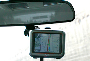
I’d like to think I know New York City very well, but the lower end of Manhattan where streets no longer run parallel and have names instead of numbers, is another story. It’s very confusing and I left the GPS home.

We drove down St. Marks Place and headed north to 8th Avenue and 45th Street. The Music Box Theater is on 45th between Broadway and 8th.

Lots of people avoid driving in Manhattan. I embrace it. It’s actually a lot of fun, if you go in with the right mindset. Just remember, the goal is to fill any open car-sized space with a car. To the victor goes the spoils!

Parking is simple. You enter Manhattan knowing you cannot park on the street and that off-street parking is ridiculously expensive. With tax, parking was $44.

At least we got to watch the cars ride the car elevator, which not only goes up and down, but also goes sideways!

The Music Box Theater is small as Broadway houses go. We sat upstairs, about halfway through the balcony The site lines were excellent, as was the sound. There’s no doubt we were looking down on the actors, which isn’t a plus.

The Farnsworth Invention portrays both Philo Farnsworth and David Sarnoff as themselves and on-stage narrators. Sometimes, as narrator, the actors break the fourth wall, acknowledging and speaking to the audience or even clarifying a point by talking directly to the other character, who remains in character!

To pull this off, you need superb timing. That’s how it’s written and how it was performed!

As the first act progressed, I grew to like the visionary character that was David Sarnoff… but was I? Was it really Sarnoff or the way he was being portrayed by Azaria? Sarnoff was quite the businessman, but was he charming too?

Hank Azaria’s voice reminded me of George Burns. I know that’s strange. Of course, Azaria has a million voices, many of which are heard on The Simpsons&#185.

The likability of Philo Farnsworth is less in question. He, a Mormon, electronics savant from the middle of nowhere, stays simple and true to his science even as everything around him gets more complex. I think Jimmi Simpson was a great choice.

The show actually has a large cast. I’m saying actually, because none of them was memorable. That’s a necessity, as they were each playing three or four little roles.

The play was written by Aaron Sorkin (West Wing, Studio 60 on the Sunset Strip, Sports Night). It tells two stories… often conflicting stories… simultaneously. From two perspectives, they piece together the life of Philo Farnsworth who, with no formal training and a limited budget, created most of the technology that is TV.

As he worked, Farnsworth raced against RCA and a team led by Vladimir Zworykin. Zworykin would ultimately get the patent, using what the play refers to as “industrial espionage,” to finish his project with bits of Farnsworth’s technology.

In the end, was this amazing discovery better off with scientist Farnsworth or broadcasting entrepreneur Sarnoff, who know how to market TV to the masses?

Maybe I’m too easy on Broadway, but I loved the show.

The entire Fox Family is back on Broadway later this week. It’s a musical.

&#185 – Moe the bartender, Apu the Kwik-E-Mart owner, Police Chief Wiggum, Professor Frink, Dr. Nick Riviera and Comic Book Guy.