When In Doubt, Blame The Weatherman… Again

georgia snow

When in doubt, blame the weatherman! Maybe there was a time that worked. It doesn’t anymore. The governor of Georgia, Nathan Deal, understands that better today than yesterday.

Tuesday at 10:00 AM, as a crippling snow and ice storm was moving through the south, Governor Deal said,

“At that time it was still, in most of the forecasts, anticipated that the city of Atlanta would only have a mild dusting or a very small accumulation if any, and that the majority of the effects of the storm would be south of here. Preparations were made for those predictions.”

Except those weren’t the predictions.

Here’s a segment of the NWS Area Forecast Discussion from Tuesday at 4:11 AM:

IN MAIN BAND FOR THE AFTERNOON AND TONIGHT…HAVE SNOW/SLEET AMOUNTS OF 1-3 INCLUDING ATL METRO. GREATEST AMOUNT ALONG A BROAD LINE FROM LA GRANGE TO THOMASTON TO LOUISVILLE. BUT SOUTH OF LUMPKIN TO MACON TO SWAINSBORO LINE…ACCUM WILL BE 0.1-0.3 INCH MIX OF SLEET AND FREEZING RAIN WITH UP TO AN INCH OF LIGHT SNOW ON TOP. ALL THESE ACCUMULATION… OTHER THAN THE NW GA LIGHT BAND…WILL MEET WARNING CRITERIA SO HAVE CONTINUED WARNING AND EXPANDED THIS TO ANOTHER TIER OF COUNTIES INCLUDING ATL METRO AREA.

FINAL NOTE…WE REMAIN CONCERNED ABOUT IMPACT WITH ONSET OF PRECIP AROUND RUSH HOUR AND SCHOOL RELEASE.

The governor has now been taken to task by pretty much everyone who knows the definition of the isobar!

Marshall Shepherd, a meteorologist with the University of Georgia and president of the American Meteorological Society, said neither meteorologists nor the forecast for the Atlanta area was to blame.

“The buses had a tough time getting kids home, but meteorologists should not be thrown under the bus,” he said.

At 3:39 a.m. Tuesday, Marshall said the weather service issued a winter storm warning for the entire Atlanta metro area, expecting 1-2 inches of snow. “Overall, the Atlanta event was a well-forecasted and well-warned event,” he said. – USAToday

This reminds me of Connecticut’s Halloween snowstorm of 2011. You remember Jeff Butler, the president of CL&P.

“But I will assure you, when we had the weather forecast and everything we looked at in preparation for this storm, the amount of snow, which ended up being the problem, was far more significant than what had been forecast,” he said.”This event as it came in Saturday started earlier and lasted longer, with more snow accumulation–and remember, all the trees still had their foliage on them.” Butler’s comments stood in stark contrast to the dire warnings issued by local television meteorologists and Gov. Dannel P. Malloy on Friday, more than 24 hours before the first flakes fell. “If we get the amount of snow that’s being forecast, a lot of people are going to lose power, and power is going to be out for an extended period of time,” Malloy told reporters at a news conference at the Legislative Office Building late Friday morning. – Hartford Courant

I don’t think so. Here’s what I wrote in my blog a few days before that storm hit.

Whatever falls will be heavier inch-for-inch than a typical storm. The snow to water ratio will be low. It’s the kind of snow that’s good for snowballs and extra slippery for drivers!

There’s one more element of this storm which is worrisome. Sustained 20-30 mph northeasterly wind with higher gusts is likely. If this wet snow clings to trees and leaves we’ll have enough wind to bring down limbs and power lines. – My Permanent Record

I wasn’t alone. NBC30’s Ryan Hanrahan’s early take:

“One of the reasons I’m unusually concerned about this storm is that the amount of leaves on the trees make them particularly vulnerable to damage. If the snow is of the heavy and wet variety we could have major and widespread power outages. We’re in uncharted territory here in terms of this type of storm this early in the season.” – Ryan Hanrahan

This same excuse was trotted out after Hurricane Sandy left Long Island powerless! Are we that easy a target?

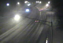
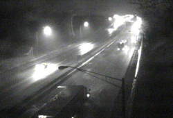
What happened in Georgia is truly a tragedy. It would have been nice to get a really long lead on this forecast, but sometimes science doesn’t cooperate. However, once the forecast is there you can’t stick your head in the sand and you can’t blame the weatherman.

Well, you can, but we’ll call you on it in a hurry.

Anyone Sick Of Winter Yet?

When snow approaches people want to know as much as we know even when we don’t know all that much!

Over on Twitter the ‘house account’ for the Meriden Record-Journal newspaper just tweeted, “Reports of snow possible towards the end of the week/weekend. Anyone sick of winter yet? #ctweather”

It didn’t take long to see a reply, “I am sick of winter and you can quote me!” That was from me.

Not even two weeks into winter officially and it’s already like being on a bad blind date looking for a strategy to bail. I need a winter wingman!

We’ve only had one real snowstorm so far, but this has been the windiest winter in a long time. December was a decidedly cold month–colder than even December should be. Now there’s the chance for snow as we head into the weekend.

Here’s one thing last winter taught me: Don’t commit too far out!

It’s OK to say what looks likely, but foolhardy to make that anything more than an advisory for planning early on. If you say something will happen with certainty you will certainly be burned! I still have scars.

120 hours out an error of a mile an hour (or less) can be the difference between heavy snow and no snow! I’m not that good. No one is.

I got a note from Dr. Mel this morning. We often chat when these larger systems approach. It’s good on both sides because speaking your mind and defending your ideas is as helpful as listening!

WE HAVE NOT ONE BUT THREE DIFFEENT CIRCULATIONS TO WATCH FOR THE END OF THE WEEK…

BUT IT IS ANYONES GUESS FROM THURSDAY NIGHT ON. THE KEY WILL BE THE TROUGH LINE. AS LONG AS IT IS SOUTH OF THE AREA, A CHANNEL FOR ATLANTIC MOISTURE WILL EXIST AND WE COULD GET BANDS OF MOD.SNOW IN THOSE SPOKES.

AS USUAL ALL THE MODELS FLIP FLOP…THE 12 Z KEEPS THING POORLY ORGANIZED, AND SHIFT THE TROUGH LINE NORTHWARD…MUCH DIFFERENT FROM OO AND 06Z RUNS.

WE WILL JUST HAVE TO WAIT WATCH…I HEAR THAT A LOT LATELY

People have accused me (and I suppose all forecasters) of hyping these storms. Why? You are just as likely to watch if we claim honest uncertainty as divine insight!

When snow approaches viewers want to know as much as we know even when we don’t know all that much!

A Storm Unlike Any Other

I called and told him I was confused because I’d never seen this particular setup before. Neither had he!

dot greenwich camera.jpgEarlier tonight I took a quick look at one of the CT DOT traffic cameras on I-95 and gasped. The camera was in Greenwich-adjacent to the New York State line. While the rest of Connecticut was seeing moderate to heavy rain with temperatures mostly in the 40&#176s Greenwich had limited visibility with heavy snow. The snow had begun to accumulate!

dot westport camera.jpgA few miles up the road in Stamford there was nothing but rain! Even now, hours later, only the communities in Lower Fairfield are seeing the snow stick.

In retrospect the Greenwich blitz doesn’t change my forecast. It was scary to see–sure. The weather had done a rapid about face. It was all part of the forecast, but it happened so quickly and with such fury I was originally taken aback.

Let me qualify this because it’s easy to lose sight of what I’m talking about.

Something’s been falling from the sky since early Tuesday. One storm came and went. This is Part B of Storm 2. However, this unnamed¹ winter storm is so unusual scholarly papers will be written about it!

Thursday while Atlantic City was seeing snow Albany, NY was getting rain. Friday morning New Haven, CT will see snow while Bangor, ME gets the rain! Crazy.

90fbw.gifThe barometer is so low it’s approaching the range usually seen in hurricanes and tropical storms. We get pressure readings this low every decade or so.
Tonight, as the wind in New London shifted from east to southwest the temperature dropped 9&#176 in one hour! Cold air advection from the southwest! Isn’t that where warm air comes from?

Seriously–that’s nuts.

I called my weather colleague Dr. Mel Goldstein this afternoon. I’d developed my forecast but was unsure about one aspect. He’s a great weather historian so I called and told him I was confused because I’d never seen this particular setup before. Neither had he!

My concern was how much warm air would remain and how much water would stay on roads as the snow fell? How would this affect Friday? My guess is a great deal of the storm will just melt as it hits the pavement–not all of it. What does accumulate will be wet and sloppy and very heavy to move.

After Friday I’ll know better how my speculation comports with the real world. I am working totally in a theoretical world right now.
I am exhausted. This week has been a killer. There’s been no forecast where I could let up because they all were jammed with critical information.

Bring on the weekend.

¹ – As long as I’ve been in Connecticut WFSB has been naming storms. It’s probably a good promotional tool for them, but on those occasions when people refer to a storm by the WFSB given name I gag. These are people who also call the Fiesta Bowl the FedEx Fiesta Bowl.