The Hurricane Center Did A Terrible Job On Ida

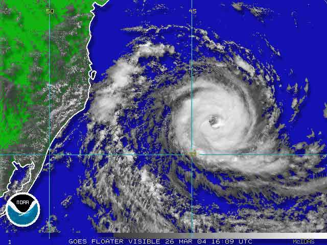
I was just having a discussion with a friend about Hurricane Ida. It’s difficult to remember a tropical system this poorly forecast.

Here’s what the Hurricane Center said in their technical discussion Friday night:

ALTHOUGH WATERS ARE WARM OVER THE NORTHWESTERN CARIBBEAN…VERTICAL SHEAR IS EXPECTED TO HAMPER MUCH INTENSIFICATION OVER THE NEXT FEW DAYS. THE GFDL AND HWRF MAKE IDA A HURRICANE OVER THE CENTRAL GULF OF MEXICO…A SCENARIO THAT DOES NOT SEEM PLAUSIBLE IN THE FACE OF WESTERLY SHEAR THAT IS EXPECTED TO INCREASE TO 50 OR 60 KT BY DAY 4.

ida-wind-fields.gifSo much for plausible! Ida was forecast to be a tropical storm now, not a powerful hurricane.

A blown forecast like this, even though the storm is far from the mainland, changes how preparations are made. When the forecast is less dependable storm preps become necessary earlier and for more storms.

Bad forecasting is costly.

That being said I can’t tell you who forecasts hurricanes better. I’m not sure anyone does. The Hurricane Center is stocked with very bright people. Most of their lead forecasters are PhDs.

I don’t know how well, or even if, NHC does post storm analysis. In cases like this I’d like to see some outside agency or (more likely) the academic community take a gander and see if there’s anything that should be done differently.

More accurate forecasting of tropical weather systems is a money saver, plain and simple.

Is Tropical Storm Danny Our Problem?

Disorganized? It should have been named Geoff.

A disorganized cluster of thunderstorms east of the Bahamas became Tropical Storm Danny earlier today.

Disorganized? It should have been named Geoff.

As I look at the path all I can think of is Bob in 1991. Danny’s projection is a bit east, though similar.

If all goes as scheduled Danny passes to our east Saturday and Connecticut hardly feels anything (except some rain). Of course schedules are fluid where tropical weather systems are concerned. A little wobble east or west will make a huge difference.

I already have weekend plans. I don’t want them to include hurricane coverage… nor does anyone who’d need that coverage.

Radio Post Mortem

My radio appearance with Faith Middleton seemed to go OK. I like being on the radio, and this didn’t spoil my opinion.

WNPR’s New Haven studio is located in a building dedicated to the arts on Audubon Street. While I waited for the elevator, I looked in at a co-ed dance class in a ground floor studio. It’s nice to see that going on.

I made a wrong turn getting off the elevator and walked into the New Haven Council for the Arts, where I spent a few minutes looking at the exhibited photos. I wonder if they’d hang anything of mine?

The WNPR studio looks like a living room. I’ve never seen anything like that before.

Faith sat in a wingback chair facing me. The control room was at my back. Our microphones were on the kind of boom used by musicians. Unlike most modern radio talk shows, Faith had no audio console. All the technical execution took place in the control room.

Mark Schleifstein, one of the authors of Path of Destruction (the definitive account of Hurricane Katrina and New Orleans) was on via telephone. Though he and I disagree about global warming in general and its specific implications for tropical weather systems, we do agree that the storms we get now are strong enough to cause lots of havoc.

When it was over, I called Helaine. She said I sounded scientific. Wow – she’s my toughest (or most honest) critic.

As I said, it was fun to do. Now we’ll see if I can stand listening to myself during the replay that’s on while I drive home.

Big Buzz In The South Atlantic

I hadn’t been on the computer more than a few seconds when I got an instant message from Bob in Florida. Had I seen what was going on in the South Atlantic?

For tropical weather systems, the South Atlantic is like Death Valley. There are a variety of reasons they just don’t form or exist there. That is, until today.

With no reconnaissance flights and little advance study, it’s tough to say 100% whether this is a tropical storm or hurricane (I guess it would be a cyclone there). But, the photo makes a very convincing case.

Based on some visible satellite image loops I’ve seen, it’s intensifying and heading toward the Brazilian coast. This storm, if it continues, will bring a type of weather unheard of to a place ill prepared to deal with it.

I have looked in all the usual places to find more information on the storm. The Hurricane Center has nothing. Same thing goes for the Navy’s FNMOC. I would doubt the Brazilians have a hurricane forecasting branch of their own.

Stay tuned. This will be interesting. And, I’m not sure it would even get a name as there’s no list for that area.