Haiti: What I Remember From Being There

It’s impossible for us to fathom what Haitian life must be like tonight. People who never had anything now have less.

haiti-beach.jpgLike you I’ve been watching the coverage of the Haitian earthquake. Each detail makes this sad story sadder. It’s difficult to imagine a spot less able to cope with this kind of adversity.

I have been to Haiti. Strange as it seems I vacationed there with my friend Neal sometime in the late 70s. We spent a week at the Club Med “Magic Isle.”

Even then Club Med never mentioned the country’s name in its promotional material. The club is long since closed, a victim of Haiti’s reputation as the basket case of the Western Hemisphere.

A few weeks before the trip we got paperwork from Club Med. We’d need to take medication before our departure. Malaria was the concern. In most of the country modern sanitation just didn’t exist. Judging by what’s coming out tonight that hasn’t changed.

We flew from JFK non-stop. Back then the airport bore the name of former Haitian president Francois “Papa Doc” Duvalier. His son, “Baby Doc,” was in charge of the country. This was an iron willed dictatorship which produced riches for a few on the backs of many.

Our bus trip through the countryside passed many streams. All were marked with health warning signs. Still there were people in each of them, mostly washing clothes. We didn’t slow down. My glimpses were brief.

Club Med “Magic Isle” itself was an armed camp. A guard station turned away locals who wanted in. Once a week local craftsmen were allowed to approach on the beach. It was obvious this part of Haiti was not for Haitians!

During our week there Neal and I never left the property.

The club itself was as beautiful as it was underused. About half the rooms were empty–this after being priced well below any other Club Med facility.

The view from my room was of stark mountains. They had been clear cut for charcoal–a cash crop. Haiti’s sister country on Hispaniola, the Dominican Republic, had similar rough hills. Theirs were covered in green!

The club was reasonably new when Neal and I arrived. Staff who’d been there for the construction told us the property was totally built by hand. There were no bulldozers or excavators. Hiring locals was much cheaper!

I was conflicted vacationing in this incredibly poor nation. I didn’t think of it before the trip, but it was tough to get off my mind while we were there. I had never been… still have never been… anywhere else with this much poverty. It was everyone. I was unavoidable… except inside the club.

It’s impossible for us to fathom what Haitian life must be like tonight. People who never had anything now have less.

The earthquake is just the first disaster. The next will diseases as dead and decaying bodies rot in place.

It is monumentally sad.

The Storm’s Over — The Numbers Are In

The dry air was the wild card. Radar showed moderate snow over all of Connecticut for hours-and-hours before anything hit the ground.

snow-shovel-on-the-steps.jpgThe snow has come and gone. There’s never a bullseye, but the forecast was reasonably close. If success is judged by number of complaints, or lack thereof, I’m doing fine. Here are the final DOT numbers. I have also added the Boston and New York NWS snow totals, which include Connecticut, for the Dec 20-21, 2009 storm at the end of this entry.

Not everyone was as lucky. A friend who forecasts in Springfield sent a text message saying he’d received nothing! “Bust of the decade,” he said. Ouch. Been there. I know exactly what he’s going through.

I was right about Southeastern Connecticut getting the most snow followed by the shoreline in general. The snow was fluffy and windblown as predicted. Accumulations were generally in line with my numbers. My call for the Northwest Hills and most of the area directly adjacent to the Massachusetts line was a few inches higher than the actual totals.

I wrote about this last night, but it bears repeating the most unusual and interesting part of this storm was the exceptionally dry air. During the summer we sometimes see 30 grams of water content per square meter. Last night it was around 1 gram per cubic meter!

The dry air was the wild card. Radar showed moderate snow over all of Connecticut for hours-and-hours before anything hit the ground. Once the atmospheric column over any location became saturated light snow turned to heavy snow. I’d never seen a situation quite like this before. It cut inches off all the accumulations.

It’s a shame this storm will impact Christmas shopping. Otherwise we’re lucky it came on a Saturday night when travel is usually light.

And now the dig out begins.

(NWS totals after the jump)

Continue reading “The Storm’s Over — The Numbers Are In”

These Snow Forecasts Never Get Easier

With all this heavyweight computing power and myriad observations this was the best we could do-vague and inconsistent guidance!

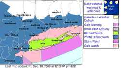
nws watches map.jpgThe weekend snow seems to be coming into sharper focus. I say “seems” because I won’t know for sure until the whole thing is gone. It’s been a wild, incredibly inconsistent ride which isn’t over yet.

Last night before going on-the-air I looked closely at the 00Z&#185 GFS and NAM models. The NAM called for a blizzard. The GFS had a windy day with light snow.

Before bed I took another look.

The 06Z runs were in. The NAM had gone from Armageddon to nothing! It was now showing the storm missing us! I sent a text message to Gil Simmons who was already preparing his forecast at work:

Geoff: Nam to 60h. Sorry snowman.

Gil: WTF. Gfs still had some measurable.

Gil: Nothing like flushing hrs of work

Gil: What a joke

He was right–What a joke. With all this heavyweight computing power and myriad observations this was the best we could do-vague and inconsistent guidance!

I went to bed.

I woke up this morning and checked my phone. Craig Allen, New York’s best known broadcast meteorologist, was on Facebook. He was complaining about the Weather Service’s freshly issued “Blizzard Watch” for Long Island. It was much too early considering the inconsistency of the forecast and the immense impact on the weekend before Christmas.

By experience on-air forecasters understand it’s easier to cancel an event than un-cancel it! There’s no harm in waiting a little while longer. On the other hand there’s plenty of downside committing to a watch too early.

Before starting this entry I took a look at the 12Z GFS and NAM. Major snow is back in the NAM. The GFS has become less of an outlier and is now closer to (but still less than) the NAM solution. These models and a few more will form the basis for my forecast today.

I will spend the next few hours mulling over each detail. How much wind? When will the snow start? Will there be a burst period? What about the critical cloud temperatures which will define the snow’s fluff factor.

In the end I’ll hope to be close. There’s no bullseye in snow forecasts. You’re never exactly right. You can only hope people are well prepared and critics cut you a little slack.

&#185 – To achieve global consistency all weather data is produced in “Z” time aka UTC or GMT. This time of year it’s five hours ahead of EST. So 00Z means 7:00 PM EST. That’s the initialization time. It takes a few hours for the results to trickle out.

The Hurricane Center Did A Terrible Job On Ida

I was just having a discussion with a friend about Hurricane Ida. It’s difficult to remember a tropical system this poorly forecast.

Here’s what the Hurricane Center said in their technical discussion Friday night:

ALTHOUGH WATERS ARE WARM OVER THE NORTHWESTERN CARIBBEAN…VERTICAL SHEAR IS EXPECTED TO HAMPER MUCH INTENSIFICATION OVER THE NEXT FEW DAYS. THE GFDL AND HWRF MAKE IDA A HURRICANE OVER THE CENTRAL GULF OF MEXICO…A SCENARIO THAT DOES NOT SEEM PLAUSIBLE IN THE FACE OF WESTERLY SHEAR THAT IS EXPECTED TO INCREASE TO 50 OR 60 KT BY DAY 4.

ida-wind-fields.gifSo much for plausible! Ida was forecast to be a tropical storm now, not a powerful hurricane.

A blown forecast like this, even though the storm is far from the mainland, changes how preparations are made. When the forecast is less dependable storm preps become necessary earlier and for more storms.

Bad forecasting is costly.

That being said I can’t tell you who forecasts hurricanes better. I’m not sure anyone does. The Hurricane Center is stocked with very bright people. Most of their lead forecasters are PhDs.

I don’t know how well, or even if, NHC does post storm analysis. In cases like this I’d like to see some outside agency or (more likely) the academic community take a gander and see if there’s anything that should be done differently.

More accurate forecasting of tropical weather systems is a money saver, plain and simple.

NFL.com Redefines Burying The Lede

So what’s the lead on this screen cap from NFL.com on my iPhone? “Titans: Stopped Patriots on 4th down.”

In journalism, the failure to mention the most interesting or attention grabbing elements of a story in the first paragraph is sometimes called “burying the lede.”

nfl-on-iphone.jpgLet me begin by burying the lede!

I know. It should be lead. God only knows why, but lede is the form used in this phrase.

Anyway, back to the story at hand.

The Patriots played the Tennessee Titans in a raging snowstorm at Gillette Stadium in Foxboro, MA. The Pats annihilated the Titans. It was 45-0 at halftime. The final was 59-0 and it really should have been 61-0 save a blown call on an obvious Titan safety.

So what’s the lead on this screen cap from NFL.com on my iPhone? “Titans: Stopped Patriots on 4th down.”

Nice try, but I don’t think so.

Tropical Storm Grace Is Totally Unimportant And Proves A Point

Before satellites this storm wouldn’t have been named. It might not have even been found!

The Hurricane Center has christened Tropical Storm Grace. It’s in a very unusual place, off the coast of Portugal. The official forecast has Grace gone sometime later today or tomorrow.

THE CYCLONE IS HEADED FOR EVEN COLDER WATER AND WILL LIKELY BEGIN TO WEAKEN VERY SOON. THE GLOBAL MODELS SUGGEST THAT THE SMALL CYCLONE WILL BE ABSORBED BY A LARGER EXTRATROPICAL CYCLONE OVER THE NORTHEASTERN ATLANTIC IN ABOUT 36 HOURS…IF NOT SOONER.

This storm is not a threat to land. It’s nearly a ‘who cares’ situation.

Before satellites this storm wouldn’t have been named. It might not have even been found!

When you read about increases in hurricane or tropical weather system activity keep that in mind. Not every statistic is meaningful. Historical data points are sparse.

Danny Moves Your Fanny

It’s unlikely we’ll get hit directly by Danny, but how much impact will there be? The line between some and none is tough to find.

danny-thurs-afternoon-plot.gifBack in Buffalo fabled morning disk jockey (and all around good guy) Dan Nevereth had a jingle (and ad campaign) which said, “Danny moves your fanny in the morning.&#185” My question is whether that will be true Saturday morning as Tropical Storm or possibly Hurricane Danny bears down on New England?

I keep looking at the data on Danny hoping to find a morsel which will give me a little relief. Nothing. It’s unlikely we’ll get hit directly, but how much impact will there be? The line between some and none is tough to find.

Added to this a planned weekend trip out-of-town. I fly out and back in not much more than 24 hours! If conditions warrant my trip is canceled. That’s not even under discussion. My first obligation is here in Connecticut.

When do I make my decision? I always tell viewers to wait until the very last moment. I’ll follow my own advice. A decision to “eat the ticket” won’t be made until Saturday morning.

No matter what Danny doesn’t look like it’s going to be a powerhouse. That’s good. The romance of a hurricane is that only in the abstract. I’ve never met anyone who felt the same way after a few days without electricity.

&#185 – Video of this commercial is not on Youtube! It’s probably the only commercial in America not online. I’d love to see a copy if you have one.

Is Tropical Storm Danny Our Problem?

Disorganized? It should have been named Geoff.

A disorganized cluster of thunderstorms east of the Bahamas became Tropical Storm Danny earlier today.

Disorganized? It should have been named Geoff.

As I look at the path all I can think of is Bob in 1991. Danny’s projection is a bit east, though similar.

If all goes as scheduled Danny passes to our east Saturday and Connecticut hardly feels anything (except some rain). Of course schedules are fluid where tropical weather systems are concerned. A little wobble east or west will make a huge difference.

I already have weekend plans. I don’t want them to include hurricane coverage… nor does anyone who’d need that coverage.

Hurricane Bill – Use The Power Wisely

I walk a thin line. I don’t want to panic people. I don’t want to lull them into complacency either.

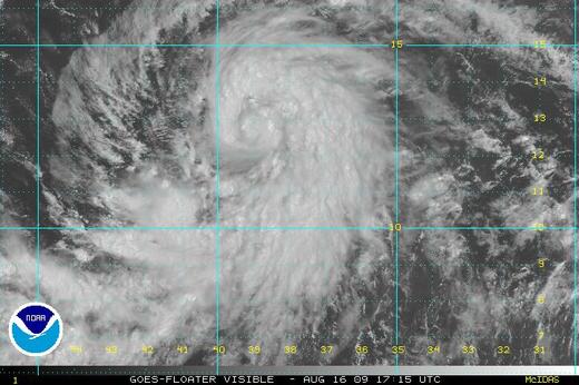
hurricane-bill-visible.jpgLet me put you in my chair for just a moment.

Hurricane Bill is headed directly toward the US mainland at the moment. That’s scary. Of course forecasting weather is not just extending the current path. There are all sorts of variables taken into account. Bill should begin a sweeping right hand turn paralleling the coast over the next few days.

There is uncertainty so I look at Bill with respect and some trepidation.

I walk a thin line. I don’t want to panic people. I don’t want to lull them into complacency either.

Not only do I have to sell the most likely scenario to the public, I have to sell it to my co-workers. They are constantly on the lookout for good stories. What would cause more interest than a storm heading our way? I can’t let them ‘wishcast’.

Mission accomplished today. We handled a hurricane preparedness story in Stonington with the gravity it deserved without sending people into shock.

I have to remain diligent. We have to use the power wisely.

The Tropics Are Open For Business

After a non-existent early season the tropics are open for business. In a few short days we’ve seen Ana, Bill and now Claudette.

tropical storm bill sunday.jpg

My folks are on their way to Milwaukee tomorrow where my niece is expecting their first great-grandchild. Her first child too, but I’ll see it through their eyes right now.

In Florida where they live there is special preferred parking for great-grandparents.

OK, I made that up, but there might as well be! It’s the Florida condo equivalent of receiving the Congressional Medal of Honor.

Anyway they fly out tomorrow. I called them yesterday.

“Get the hurricane shades rolled down.”

I’m glad they’ll be out-of-town.

After a nonexistent early season the tropics are open for business. In a few short days we’ve seen Ana, Bill and now Claudette. Ana fizzled. Claudette will cause problems on the Gulf Coast, but probably as a tropical storm of minimal hurricane. Bill is the big worry.

I am actually more worried about Bill than Claudette even though Claudette will surely make landfall while the track of Bill is nowhere near as well defined.

ENVIRONMENTAL CONDITIONS APPEAR FAVORABLE FOR CONTINUED INTENSIFICATION DUE TO LIGHT SHEAR AND WARM WATERS. SSTS BEGIN TO RISE MORE SIGNIFICANTLY IN A COUPLE OF DAYS AND THE NHC INTENSITY FORECAST COULD BE CONSERVATIVE AFTER THAT TIME. ALL RELIABLE GUIDANCE SHOWS THIS SYSTEM EVENTUALLY BECOMING A MAJOR HURRICANE. – National Hurricane Center discussion

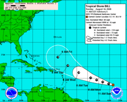
bill track sunday.gifI don’t disagree. And since this storm seems to be destined to turn parallel to the East Coast I worry–not just for my parents.

As storms get closer to land the ability to monitor them improves. Hurricane Hunter flights don’t go out into the mid-Atlantic. Buoys and remote sensors are limited in the middle of the ocean. Radar only covers a few hundred miles from shore.

This will not be my last entry on Bill.

Speaking To The Dentists

I think it went well. Who can really tell?

I left the station between newscasts and headed to the New Haven Country Club to speak to the New Haven Dental Society. They didn’t know what to expect and I wasn’t sure I was who they wanted to see. I packed my laptop and hurricane presentation.

I delivered my talk as dinner was served. OK–not optimum but they were attentive. Good questions followed which is always a good sign.

I think it went well. Who can really tell?

The problem with my presentation is there’s no neat bow to tie around it at the end. I worry that there are no plans should a hurricane hit Connecticut… and hurricanes hitting Connecticut aren’t a terribly unusual occurrence. Instead of ending with answers I end my presentation with a question.

The Melt Before The Storm

Connecticut will roll up the sidewalks sometime Saturday afternoon. I feel bad about that because restaurants which make a large portion of their weekly take on Saturday nights will suffer. They had it better years ago when their customers would eat and get stranded.

It is a spectacular day in Connecticut. The Sun is out and unfettered by clouds. The breeze is light. Everywhere I look things are melting.

There are some pictures at the bottom of the entry. You can see how the driveway has become visible again as has our ‘pet’ rabbit, Eddie. The ice on our front steps is melting and soaking into the brick.

Another day like this and we’d be nearly snow free. Right.

If there’s an opposite of wind chill it’s in effect today. The thermometer temperature is 30&#176, but it could easily pass for 45&#176. In a less enlightened time there’d be no hint another snowstorm is coming tomorrow.

My company’s Holiday Party, normally scheduled for this quiet period after Christmas and New Years, has already been postponed. It’s not the only thing that will close. Connecticut will roll up the sidewalks sometime Saturday afternoon. I feel bad about that because restaurants which make a large portion of their weekly take on Saturday nights will suffer. They had it better years ago when their customers would eat and get stranded.

I have checked and double checked the computer runs. They’ve been reasonably consistent with the precipitation amount and cloud temperature. The onset time has slid a few hours later from what I said yesterday. It’s an inexact science.

This will be a moderately large snowfall–more than 6″ but under a foot.

semi-bare-driveway.jpg

front-steps-ice.jpg

snowy-rabbit.jpg

Just Another Football Sunday

The daytime games didn’t hold much more than peripheral interest for us, though I enjoyed watching Oakland and New England play a full four quarters in heavy rain.

“I’m going to fold these jeans and leave them near the bed for tomorrow,” I told Helaine last night. “Right,” she said. “Will you even be up for the first game?”

OK–I never got out of my pajamas today. I didn’t take the camera out as I’d planned. In fact I barely made halftime before coming downstairs. I hate it when she knows more about me than I do.

We spent the day watching football on TV. The daytime games didn’t hold much more than peripheral interest for us, though I enjoyed watching Oakland and New England play a full four quarters in heavy rain.

With the Eagles way behind we’ve taken to rooting against teams hoping for entree to the NFC wild card. Lose Redskins. Lose Cowboys. Lose Atlanta. We got two of three.

“Go Giants,” Helaine said earlier today. Really? It’s come to that? How sad.

Whole Lotta Quaking

“Didya feel it?” I wrote.

I shudder to think how many alerts my friend Farrell in Palm Springs has sent to his Blackberry. I know for sure one of them comes from a local TV station.

Subject: Breaking News – 3.2 Earthquake Near Borrego Spring

Live from KESQ the Desert’s News Leader.

A magnitude-3.2 earthquake struck eight miles north of Borrego Springs and about 32 miles south-southeast of Palm Springs at 7:37 p.m., according to the U.S. Geological Survey. There are no reports of injuries or damage at this time. For the latest details watch KESQ Newschannel 3 at 5 PM, 6 PM and 11 PM and stay up to date with breaking news from KESQ.com

http://www.kesq.com

24 hours a day.

I’d be down on my knees praying for forgiveness, but a 3.2 is pretty puny in shaky California. I can’t imagine the locals will lose any sleep.

“Didya feel it?” I wrote.

“No,” he answered. “The only vibration I felt was the BlackBerry notification.”

Tonight’s top story from the desert and you heard it first on geofffox.com

Bad Night In Galveston

At some point there’s got to be personal responsibility. Society can’t immunize people against stupid choices.

Tonight on the news we reported a large number of people have decided not to leave Galveston Island. Talking to my mom tonight on the way home, she mentioned someone from Galveston on Nightline saying she’d be OK because she has a life preserver.

From Houston Chronicle: As Hurricane Ike pushed a swelling surge onto Galveston Island this morning, many of the estimated 23,000 Galveston residents who ignored a mandatory evacuation order phoned for rescues to no avail because emergency workers were called off the streets, officials said.

That’s about as scary an opening paragraph as I’ve ever read. It’s not like there hasn’t been warning. Thursday the Weather Service made a doomsday pronouncement for Coastal Texas:

ALL NEIGHBORHOODS…AND POSSIBLY ENTIRE COASTAL COMMUNITIES… WILL BE INUNDATED DURING THE PERIOD OF PEAK STORM TIDE. PERSONS NOT HEEDING EVACUATION ORDERS IN SINGLE FAMILY ONE OR TWO STORY HOMES MAY FACE CERTAIN DEATH. MANY RESIDENCES OF AVERAGE

CONSTRUCTION DIRECTLY ON THE COAST WILL BE DESTROYED. WIDESPREAD

AND DEVASTATING PERSONAL PROPERTY DAMAGE IS LIKELY ELSEWHERE.

VEHICLES LEFT BEHIND WILL LIKELY BE SWEPT AWAY. NUMEROUS ROADS

WILL BE SWAMPED…SOME MAY BE WASHED AWAY BY THE WATER. ENTIRE

FLOOD PRONE COASTAL COMMUNITIES WILL BE CUTOFF. WATER LEVELS MAY

EXCEED 9 FEET FOR MORE THAN A MILE INLAND. COASTAL RESIDENTS IN

MULTI-STORY FACILITIES RISK BEING CUTOFF. CONDITIONS WILL BE

WORSENED BY BATTERING WAVES CLOSER TO THE COAST. SUCH WAVES

WILL EXACERBATE PROPERTY DAMAGE…WITH MASSIVE DESTRUCTION OF

HOMES…INCLUDING THOSE OF BLOCK CONSTRUCTION. DAMAGE FROM

BEACH EROSION COULD TAKE YEARS TO REPAIR.

At some point there’s got to be personal responsibility. Society can’t immunize people against stupid choices.