The Storm’s Over — The Numbers Are In

The dry air was the wild card. Radar showed moderate snow over all of Connecticut for hours-and-hours before anything hit the ground.

snow-shovel-on-the-steps.jpgThe snow has come and gone. There’s never a bullseye, but the forecast was reasonably close. If success is judged by number of complaints, or lack thereof, I’m doing fine. Here are the final DOT numbers. I have also added the Boston and New York NWS snow totals, which include Connecticut, for the Dec 20-21, 2009 storm at the end of this entry.

Not everyone was as lucky. A friend who forecasts in Springfield sent a text message saying he’d received nothing! “Bust of the decade,” he said. Ouch. Been there. I know exactly what he’s going through.

I was right about Southeastern Connecticut getting the most snow followed by the shoreline in general. The snow was fluffy and windblown as predicted. Accumulations were generally in line with my numbers. My call for the Northwest Hills and most of the area directly adjacent to the Massachusetts line was a few inches higher than the actual totals.

I wrote about this last night, but it bears repeating the most unusual and interesting part of this storm was the exceptionally dry air. During the summer we sometimes see 30 grams of water content per square meter. Last night it was around 1 gram per cubic meter!

The dry air was the wild card. Radar showed moderate snow over all of Connecticut for hours-and-hours before anything hit the ground. Once the atmospheric column over any location became saturated light snow turned to heavy snow. I’d never seen a situation quite like this before. It cut inches off all the accumulations.

It’s a shame this storm will impact Christmas shopping. Otherwise we’re lucky it came on a Saturday night when travel is usually light.

And now the dig out begins.

(NWS totals after the jump)

Continue reading “The Storm’s Over — The Numbers Are In”

Gustav Hits Jamaica

“European, best overall model in world by far has Hanna hitting New Orleans harder than Gustav.” He’s right, but it’s just a curious model output–nothing more.

Not a great tourist day on Jamaica. Manley Airport near Kingston has been reporting winds in the mid-40 mph range. Not sure why, but they don’t report gusts.

Jamaica has seen worse–little consolation. Mudslides are often the product of this kind of weather.

My buddy Bob in Florida hit me up on IM. “European, best overall model in world by far has Hanna hitting New Orleans harder than Gustav.” He’s right, but it’s just a curious model output–nothing more.

4:09 PM Me: that is scary–but it’s over a week out!

4:10 PM Bob: yes, i didn’t say i believe it

There is no forecasting skill for this type of storm over that period of time. Even knowing that, folks like us still look at the maps as far as they go.

If Gustav ‘attacks’ New Orleans everyone will evacuate. If Hanna follows on Gustav’s heels they’ll leave again. I’m not sure they’ll return.

Gustav Now On My Radar

The route is totally different from Katrina’s, but the projected destination is eerily similar.

Three years ago today I was on the phone with Farrell’s mom Ruth, try to get her out of New Orleans. Here’s what I wrote that day. Now I’m worried about New Orleans again.

Gustav is south of Cuba, heading toward Jamaica and the Cayman Islands. The route is totally different from Katrina’s, but the projected destination is eerily similar.

Much of the controlling mechanism behind hurricanes is seasonably predictable. At different times in the hurricane season different areas are favored for development and track. It’s not a big surprise a potential hurricane is aiming at the mid-Gulf Coast on Katrina’s anniversary week.

Gustav will gain strength. It’s tough to think it will go anywhere but the Gulf. I’m scared it will plow into the Gulf Coast states. I hope I’m wrong. It’s a hope I have too often during the hurricane season.

A Surprise Lesson From Hurricane Dean

Recently, Hurricane Dean formed in the Atlantic, blew through the Lesser Antilles (Do they feel any inferiority with that name?), Jamaica, the Yucatan Peninsula and finally Mexico&#185.

Rightfully, Dean was classified a Category 5 hurricane. Top winds were reported as high as 160 mph. Dean was the first Category 5 storm to strike land as a Category 5 since Hurricane Andrew hit South Florida, 15 years ago.

The Global Warming chorus started up. “This is a sign of what’s to come,” was the message. “Look how much stronger these storms have gotten.” It’s a scary message.

Here’s the headline on a release I got a few days ago:

What We Don’t Know About Hurricanes

By virtue of the environment necessary for their formation and the latitude at which they travel, hurricanes are mostly slow movers. Sometimes they progress at walking speed. Other times they spin in place or loop around their own path.

That slow speed makes forecasting very difficult. The slower the environmental winds are carrying you, the more likely it is for something weak… something we may not see or properly model… to affect your path.

With all this in mind, it’s no surprise hurricane forecasts are less than ideal. The photo on the left represents most of the tropical prediction models for Hurricane Dean. Maps like this are generally called ‘spaghetti plots’.

Notice how they’re in reasonable agreement early on, but diverge as time goes by. That’s a lot of ‘maybe’ in the predicted Gulf Coast landfall.

During the day, Monday, the first shots of Dean’s damage on Jamaica will become available. I expect to see major destruction on the immediate coast.

Why Is That 737 Heading To Jamaica Tonight?

Sometime today, probably mid afternoon, Jamaica will get creamed by Hurricane Dean. It’s not a pretty scenario. Imagine watching a train barrel toward you while you’re tied to the tracks!

In the midst of this tumult, a chartered jet is heading into Norman Manley Int’l Airport in Kingston.

How do I know? I went on FlightAware and looked to see air traffic in and out of Kingston. I can only see flights which will touch Jamaica and the U.S., but that’s enough for a feel.

The plane is question is a Boeing 737 owned by Ameristar Jet Charter, operating from Addison Airport near Dallas. It’s a plane normally used for charters and configured 100% first class. There are only 56 seats.

Why is it flying there? Is it a rescue flight of some type? If so, why a plane with so few seats?

More importantly, will it get out before Hurricane Dean shuts things down? Any kind of mechanical trouble would be very costly. In this case time is money.

At the last observation, winds at Kingston were light. It is just another sultry tropical evening in the heart of the Caribbean. You can see how people were totally surprised by these storms in the pre-electronic era.

There will be enough damage in Jamaica without a perfectly good 737 being ripped to shreds. I hope they refuel and return to Texas quickly.

Hurricane Dean – Living Up To Its Billing

At work, we’ve got new graphics computers and software. With Dean in the Atlantic, I’ve been giving them a workout… or at least better learning how to use them. These storms can be tracked, predicted and shown in a variety of ways.

Right now, the Hurricane Center says Dean has sustained winds of 135 mph. I’m more likely to agree with NHC tonight than last night. Dean has become a classic hurricane with a well defined eye.

I popped over to the San Juan, PR radar and watched the outer bands spin as the storm passed to the south. Later, the huricane will be visible from a radar at Guantanamo and a few (if they’re working) on Cuba.

It will not be a good weekend in Jamaica. The official call brings Hurricane Dean right over the spine of that mountainous island Sunday. In that scenario you get devastating wind and rain, storm driven tides and huge mudslides. The Caymans aren’t much better off.

It’s possible tonight’s 135 mph is near Dean’s peak. Even if he does strengthen (as forecast), there is a limit. It’s tough for a storm to maintain 150+ mph winds for long before internal forces begin to break down the storm.

There’s lots of watching to come. Dean will be ‘on the books’ until midweek next week.

Hurricane Dean – At The Antilles

Tonight, the Hurricane Center deemed Hurricane Dean’s winds to be sustained at 100 mph. Sure, why not?

I actually don’t think they’re blowing that fast. I’m basing my estimate on the look of the satellite imagery, surface observations and the Martinique radar.

The chain of islands Dean is approaching, the Antilles, will be quickly passed. Though Dean might damage them, they won’t slow Dean much at all. That seems unfair.

The next two days will probably see significant strengthening of this storm as it enters the Caribbean. On TV, meteorologists and others will point out Dean’s well defined and circular eye. We can’t do that quite yet.

The official pronouncement from the Hurricane Center calls for a period of Category 4 winds. There’s no certainty, but that seems a reasonable call. Dean is entering an area primed to be hurricane fuel.

Jamaica, the Caymans and the Yucatan Peninsula are all under attack if Hurricane Dean follows the computer guidance (amazingly in agreement with each other right now). All three areas are quite vulnerable.

After Katrina, some people were left with a false impression. There aren’t many places that can flood like New Orleans. Certainly none of the places I just mentioned floods that way.

The major damage from Dean will be related to strong, destructive winds. If you want the Katrina analogy, that’s the kind of damage produced on the Mississippi Coast.

A less sexy story, Mississippi a whole lot less news coverage than New Orleans. The damage was nonetheless catastrophic. Let’s hope I’m wrong.

My Classmates Experience

I read a listing of the most popular sites on the Internet and saw Classmates.com listed. I was surprised. Last night, before going to bed, I went and took a look.

I signed up for a free account and began to systematically look at every listing from my high school and graduation year. It was a huge school. My graduating class had nearly 2,000 students.

Through the A’s, B’s C’s and D’s – nothing. No friends. Not even a recognition of the names. Didn’t I know people? It’s possible I didn’t, as there’s no one from high school I’m still in contact with.

Finally a few names rang a bell. I just couldn’t remember if we were friendly, or I just knew the name.

Howard Epstein was there.. Was this Howie Epstein? Is this the guy who rebuilt a Model “A” Ford, putting the transmission in upside down? Am I even remembering the name correctly?

Where was the guy who used to leave English class to call his stock broker? This was the mid-60s. No one I knew owned stock, much less had a broker to call on a daily basis. He wore a three piece suit to school. Was his name Immerman?

I graduated at the height of the Vietnam War. One of my classmates went on to West Point. Did he make it through the war? Did he even make it through four years at West Point?

I saw one classmate listed who lived in my apartment building. We went to high school together for four years, traveling an hour and a half in each direction by bus and subway. As far as I remember, we had nothing in common and never spoke. At least I recognized the name.

Where were the guys I used to ride the GG and 7 train with? Who did I eat lunch with? Anyone from the A/V squad? I’m at a loss.

I did see George Sau listed, and dropped him an email. George and his brother Johnny lived in a very tough neighborhood in Jamaica. When I’d visit their family’s Chinese food take-out place, they’d be the only Asians in the area… and I, the only Caucasian.

I’ve heard sites like Classmates are responsible for some marriage breakups, as spouses reconnect with old flames. I went to an all boy’s school. I was socially inept back then. It’s not a concern.

Do I really want to find the people I knew in the late 60s? That’s not as simple a question as it sounds. Better still, do I want them to find me?

How much of what I was back then am I now?

You Never Forget Your First… Storm

So, here we are on June 10, and the first tropical system has formed in the Caribbean. Winds are ‘light’ at the moment. The storm remains an unnamed (only numbered) tropical depression.

Last year’s first storm formed on June 8 and in a similar place. It became Arlene and was an early non-entity.

People in Jamaica and the Cayman Islands have been dealing with torrential rains from this system for the past few days. We’re talking feet of rain, not inches!

I’m curious to see how this hurricane season plays out. For me, there’s awareness of every system – after all, it’s my job. Most people only perk up for the big ones… or at least that was the case until last year.

Will people hang on every word about storms destined to stay with the fishes? Probably – at least for a while. In years past, we often disregarded them on TV. This year, disregard at your own peril.

When this year’s season is over, and the hurricane count is down from 2005 (as it almost certainly will be), will those who make the connection between tropical systems and global warming make excuses? Probably.

If the count is up, I’ll certainly reevaluate my beliefs.

This first system… this little Alberto wannabe… looks like it will cross Florida and then parallel the East Coast. This time of year it’s tough for a storm to maintain any strength in the relatively chilly Atlantic. It’s also tough for a storm to have any westward motion – critical for it ‘hitting’ land from the Atlantic.

As far as I can tell, there’s never been a landfalling hurricane on the East Coast that moved through the Gulf.

Lots of eyes will be on this system. Lots of eyes will be on the Hurricane Center and anyone who forecasts the weather.
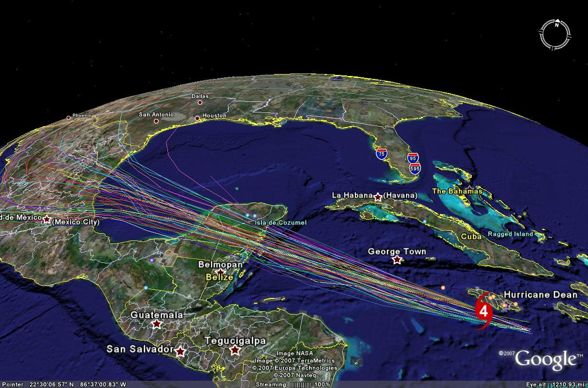
The “A” storm is usually pretty docile. Sort of like training wheels for weathermen. Except when they aren’t – Andrew, for instance.

Those were the ‘good old days.’ Back in 1992, Andrew didn’t form until mid-August. By August 16, 2005, we’d already seen Irene.

Blogger’s note: On the right side of the page, you’ll see links to the Hurricane Center’s official forecasts. Those are dynamic links which update through the season dozens of times a day.

The Meisels Go Home To New Orleans

Back when Hurricane Katrina was threatening the Gulf Coast, I did my best to get Ruth Meisel out. The day she drove to safety up north was the last time she saw her home, until yesterday.

With her two adult children in tow, Ruth Meisel returned to New Orleans to see what could be salvaged and tie up loose ends. She will be among the tens, maybe hundreds of thousands, who will leave their homes and move elsewhere.

New Orleans is being abandoned, wholesale.

I asked her son, my friend, Farrell to type some of his thoughts so I could put them here in the blog. I’ll sprinkle a few of his photos here, though the best way to see them is in this slideshow.

Clean up goes on. 80% of the city was affected. Some parts of the city have begun to function, albeit at half speed. This area is still without electricity and is deemed unsafe. It’s expected that electricity won’t be restored in New Orleans East for six to nine months. My mother returned for the first time since the hurricane and subsequent floods, to survey the damage and see if anything could be saved. She’s suited up and ready to go inside. In the background, my sister, Cheri, ready to suit up, as well.

It’s nice… no, it’s amazing to see Ruth smiling.

Here’s my read. She could be distressed with what she’s about to see, or she could be happy to see she raised her children right, and they are accompanying and supporting her. She chose the latter.

My mother knew from earlier reports and a prior visit by my sister, that things didn’t look so good. She’s been very optimistic and hopeful, looking forward and giving us much encouragement. My mother’s house survived the storm on the outside, but the inside looked and smelled awful and was a total disaster. Entering the front door we were greeted by a living room chair that wasn’t there when my mother left in August. That gives you an idea of how we were greeted.

From the marks on the wall it looks like 4-5 feet of water made it into the house. From the ‘bunny suits’ the Meisel’s wore, you can assume it wasn’t spring water.

Nearly everything was ruined.

One of the things that struck Farrell when we spoke on the phone was the proliferation of signs advertising Katrina related services. There are also markings, scrawled on homes with spray paint.

This house has been FEMA’d. FEMA is not an acronym here. It’s a four-letter word. BTW, so is Bush.
One of the city’s synagogues, Beth Israel, an Orthodox house of worship…Also one of the city’s oldest, which used to be in the historic uptown area until the late 1960s. Also on Canal Blvd, note the watermarks. Reportedly, the head Rabbi fled town, leaving the Torah scrolls to flood and be rescued from religious volunteers. The Rabbi has since been fired. My sister spotted prayer books and prayer shawls on the ground in front of the now-deserted synagogue….a sin in the Jewish religion.

Here’s how Farrell ended his note, and I’ll leave it pretty much intact:

As I visit here, for the first time in several years, 3 months after the devastation that has been chronicled worldwide, I have now discovered: A Missing City. Parts of the city and neighboring parish (Jefferson) we have seen are beginning to function, but it’s slow and without spirit.

In our many conversations with New Orleanians and Jeffersonians, one hears a great deal of anger leveled at Government. I could only find one person with a nice thing to say about President Bush. I asked why? The waitress at the seafood restaurant said it was the Louisiana Governor’s fault for not letting Bush send FEMA and the troops in. I then asked, out of curiosity, did she know that Bush was on a fundraising trip in California for three days before he did a “fly-over”, VP Cheney was buying a vacation house and the Secretary of State was shopping in Manhattan, while her home state, Alabama, was flooded. The waitress hadn’t heard that.

A newspaper stand owner or manager clearly vented his anger towards Bush, but didn’t spare either the local, regional and state governments, but felt, the US Government let Louisiana down.

Most of the Greater New Orleans area, (Orleans and neighboring parishes), as it’s known, with some 1 million people once living there, don’t have electricity, a home, assistance from FEMA, insurance companies, and they feel forgotten just three months after the hurricane and floods.. As is the case with crises the world over, once the cameras leave, the sense of urgency goes with the camera crews.

The stores and shops that are open are operating for limited hours due to two factors: limited shoppers and limited staff.

It’s quite unusual to be driving in one part of the area, say neighboring Metairie, where the shops and malls have reopened, only to continue on Interstate 10 to downtown New Orleans, and pass through darkness because whole areas have no power.

There were some signs of life downtown and in the French Quarter. The beautiful St. Charles Avenue historic areas seemed to be untouched and lit, yet, just a few blocks away, one would have thought we could have been in a war zone.

Rumors of price gouging exist. Household stores are reportedly charging double for goods consumers can buy in the middle of the state or in Mississippi for less. Gasoline is 30 cents a gallon more expensive than in the center of Mississippi or Louisiana reportedly.

Residents feel abandoned now. From the newspaper shop owner to restaurateur, residents don’t feel the city of N.O. census will approach even half of it’s close to 461,000 registered residents.

Employers are looking for employees. Potential employees are looking for housing, assistance from FEMA and the insurance companies, and those are the few, who have returned.

The Times-Picayune reported today that the New Orleans Mayor, Ray Nagin, rumored to be in Washington on business, actually wasn’t there on business, but took his family on vacation to Jamaica. While I’m sure he’s deserving of a break, there are several hundred thousand to one million people, who’d love to take that break, if only they could get some help from the various government agencies so they could get on with their lives and rebuild. And I haven’t even begun to discuss the levee system.

As I write this at 2am Central Standard Time, I was trying to think, after only two days here, how could I best describe what I have seen and heard? The word that comes to mind is “abyss.”

New Orleans, which had once been described as the “city that care forgot,” from an old Mardi Gras tale, has become the bottomless gulf or pit. There are only a handful of truly unique cities in the U.S. with some history and character. When tourists think of those cities, New Orleans had always been in the same company with San Francisco, Boston, New York, Savannah, and perhaps one or two other cities or towns.

It would not be an exaggeration to suggest, if there is no sense of urgency, New Orleans could drop off that list in my lifetime.

Please, look at the pictures. It is so sad… so tragic.

Quoted In The Norwich Bulletin

I think I’ve become the low hanging fruit of weather quotes. I was included in an article published today in the Norwich Bulletin.

Use the link above if you want to read it, though I’m attaching it to the jump should that link go stale.

Continue reading “Quoted In The Norwich Bulletin”

Ivan and Jamaica

I can only imagine what it’s like to be on Jamaica tonight. Observations from the airport stopped hours ago, but the Hurricane Center has upped the wind estimate on Ivan to 150 mph.

This will be a devastating night for Jamaicans.

I have been living this nightmare in my mind for the past two days. Once it became obvious where Ivan was going, all I could do was put together the pieces. Construction isn’t good. The island is mountainous and prone to slides. There are a few hundred rivers… really mountain fed streams… to overflow.

In a few days we will get documentary proof in the form of video. No matter how bad it looks, it would have been worse to be there.

Worried Sound

I spoke with my parents and my friend Wendie today and I heard the same thing from all of them – apprehension. With Hurricane Ivan threatening Jamaica, and the projected path aiming somewhere near Florida, they’re worried.

In the abstract, Hurricane Frances loomed as an adventure. In reality, it was a lot tougher to take – and they didn’t get a direct hit. It is tough under those circumstances not to think about the worst case scenario.

I made the offer again to my folks to come up here to Connecticut for a while. They begged off. No one wants to be driven from their home.

I hope, as is often the case, Ivan changes course and spares Florida. Unfortunately, you can’t will the forecast to happen.

Ivan Has a Growth Spurt

The Hurricane Center has just upped Hurricane Ivan to a Category 5 with top winds of 160 mph with higher gusts! That means winds with 2.5 times the force of Frances at landfall and four times the potential to cause damage.

Complete roof failure on many residences and industrial buildings. Some complete building failures with small utility buildings blown over or away. All shrubs, trees, and signs blown down. Complete destruction of mobile homes. Severe and extensive window and door damage. Low-lying escape routes are cut by rising water 3-5 hours before arrival of the hurricane center. Major damage to lower floors of all structures located less than 15 ft above sea level and within 500 yards of the shoreline. Massive evacuation of residential areas on low ground within 5-10 miles (8-16 km) of the shoreline may be required. There were no Category Five hurricanes in 1995, 1996, or 1997. Hurricane Gilbert of 1988 was a Category Five hurricane at peak intensity and is the strongest Atlantic tropical cyclone of record.

Tonight, my friend Bob and I were chatting about hurricanes. We realized, as bad as this season is, deaths have been low. This is 100% attributable to satellite technology. In fact, Bob suggested whoever ‘invented’ weather satellites deserved a Nobel prize for that alone!

I worry about the people on Jamaica. This storm is steaming right toward them and there’s really nowhere to hide.

Not only will the wind be destructive, but Jamaica has topography which will bring out the worst in a hurricane.

Jamaica is about the size of Connecticut in the United States. It measures about 4,400 square miles (11,400 square kilometers).

Stretches 146 miles from east to west. Varies between 22 and 51 miles from north to south. And in many ways is more like a continent than an island.

It has rugged mountain ranges, with Blue Mountain Peak, the highest point, soaring 7,402 feet. It has miles of white beaches, bordered by the blue Caribbean.

It has 120 rivers flowing from the mountains to the coast. And it has great central plains, fertile agricultural lands, towering cliffs, magnificent waterfalls, dense tropical forests…and eternal summer.

From 1uptravel

Seven thousand foot mountains will surely wring more than the Hurricane Center’s estimate of 5-7″ of rain. A direct, or even near, hit will mean catastrophic mudslides and flooding.

This storm is not done yet.