Here Comes Bertha

al932014

al932014_inten

It takes a while for the Atlantic hurricane season to get going. The real action is still far ahead.

Meanwhile, out in the Tropical Atlantic a cluster of thunderstorms is being eyed by the National Hurricane Center. It is Atlantic Invest 93. It will become Bertha.

This “Invest” stuff is a recent addition to the hurricane info deluge. It’s a heads up more than anything.

The storm is probably headed to the northern islands of the Caribbean–possibly the Virgin Islands, then northwest into the open ocean. There’s a lot of wiggle room between now and the weekend.

Intensity forecasts say tropical storm, possibly low end hurricane. Intensity forecasts are notoriously awful.

Up the East Coast? There’s that potential, though the most common track would is well offshore.

It will be watched closely.

Graphics from the math geeks at UW Madison.

Hurricane Sandy: NWS Assesses Itself

www.nws.noaa.gov os assessments pdfs Sandy13.pdf-1

The Weather Service just released its Hurricane Sandy “Service Assessment.” Publications like this aren’t unusual. Every named or numbered storm gets some sort of after-the-fact scrutiny. Of course, Sandy is a special case, having affected so many people and so much property. This is a beefy report touching lots of bases.

The Weather Service and Hurricane Center did a good job–not good enough. There were weak points. That’s me speaking, though the report acknowledged them too.

I was on-the-air at FoxCT for Sandy. We used lots of NWS/NHC raw data and forecast products. A huge part of my job was assimilating the immense treasure trove of data available. Some of what we used was so esoteric, co-workers didn’t know it existed!

If there’s ever been a time my years of experience and nerdy curiosity came in handy, it was during Sandy.

Once Sandy moved north of Cape Hatteras the National Hurricane Center passed off much of its responsibilities to local forecast offices. That was a big mistake which served to confuse more than inform.

www.nws.noaa.gov os assessments pdfs Sandy13.pdfI said it then. Even worse, I’d said it before, having complained loudly and traded emails with the Hurricane Center’s director Ed Rappaport after Hurricane Noel received the same pass-off in 2007.

This Hurricane Center policy will be changed going forward. It’s about time!

For future storms like Sandy, NHC should be the principal point of contact responsible for the event, including delivery of a consistent suite of products and a unified communications protocol within NOAA, to key NOAA federal partners, and the media. NOAA/NWS websites should consistently reflect all watch/warning/advisories on websites, regardless of organizational structure or office/center responsibility. Web page design should ensure the most important message is quickly evident.

The are other recommendations, including a some having to do with coastal flooding and the current lack of definitive storm impacts. Giving a tidal flooding range in feet is worthless to most people. More important would be to say, “Lower Manhattan will be under water,” or similar specifics.

The truth is most non-professionals need a trusted voice. There’s too much for you to wade through.

I hope I was your trusted voice, leading you in the right direction. If you were watching us on FoxCT you weathered the storm without any big surprises. It goes without saying I will miss being that voice for you in the future.

The NWS assessment and its findings and recommendations should help all of us do better next time. There will be a next time.

There’s No Tropical Storm Beryl… Yet

From the National Hurricane Center: ENVIRONMENTAL CONDITIONS ARE EXPECTED TO BECOME MORE CONDUCIVE FOR DEVELOPMENT ON SATURDAY OR SUNDAY…AND THIS SYSTEM HAS A HIGH CHANCE…80 PERCENT…OF BECOMING A TROPICAL OR SUBTROPICAL CYCLONE DURING THE NEXT 48 HOURS.

The Hurricane Season doesn’t begin until next week. We’ve already had Alberto. Now we might be getting Beryl.

From the National Hurricane Center: ENVIRONMENTAL CONDITIONS ARE EXPECTED TO BECOME MORE CONDUCIVE FOR DEVELOPMENT ON SATURDAY OR SUNDAY…AND THIS SYSTEM HAS A HIGH CHANCE…80 PERCENT…OF BECOMING A TROPICAL OR SUBTROPICAL CYCLONE DURING THE NEXT 48 HOURS.

As I wrote during Alberto, there’s a reason we don’t usually get tropical systems this time of year. When conditions are conducive for intensification they’re only marginally conducive and only in a very small area.

Unfortunately one of the long range computer models brings Beryl up-the-coast by next Friday.

Likely? No. Possible? Yes.

Long range forecasting of tropical systems is notoriously poor. I’ll keep my eye on it.

NHC Admits Alberto Is Weak… And It’s Actually Weaker

Residents of Connecticut (Hey, that’s us!) have every right to be sensitive to weather systems like Tropical Storm Alberto. We know tropical storms can raise hell! Any romance in tropical weather is gone for us.

Breath easy. The trends I wrote about early this morning continue. The Hurricane Center continues to admit Tropical Storm Alberto is weaker than their official pronouncement.

From NHC: OBJECTIVE AND SUBJECTIVE INTENSITY ESTIMATES ARE ALL SUGGESTING AN INTENSITY AROUND 35 KT…BUT THE ADVISORY INTENSITY IS ONLY BEING LOWERED TO 40 KT FOR NOW.

That’s not unusual. There really isn’t a single wind speed that can be used to accurately identify a system.

More important, Alberto will be a victim of his own premature birth.

From NHC:ALBERTO APPEARS TO HAVE AT LEAST THREE STRIKES AGAINST ANY RE-INTENSIFICATION. FIRST…DEWPOINTS OVER SOUTHEASTERN U.S. ARE ROUGHLY 50 DEGREES FAHRENHEIT…AND THE CYCLONE IS LIKELY INGESTING SOME OF THIS DRY AIR. SECOND…THE CENTER IS MOVING WEST OF THE GULF STREAM OVER COOLER SHELF WATERS NEAR THE SOUTH CAROLINA/GEORGIA COAST. AND THIRD…UPPER-LEVEL WESTERLY WINDS ARE EXPECTED TO INCREASE OVER THE SYSTEM DURING THE NEXT 24 HOURS.

Anyone getting breathless about Alberto is engaging in hype. ‘Nuff said.

Tropical Storm Alberto

You’re not the only one surprised to see a named tropical storm so early. Joe Furey said the GFS model had something like this ten days ago, but it wasn’t anything I was concentrating on. This afternoon the National Hurricane Center turned a low off South Carolina into Tropical Storm Alberto.

The Hurricane Center’s is on the case. Their latest discussion is three long paragraphs saying, “We really don’t know.”

This afternoon the National Hurricane Center turned a low off South Carolina into Tropical Storm Alberto. You’re not the only one surprised to see a named tropical storm so early.

Joe Furey said the GFS model had something like this ten days ago, but it wasn’t anything I was concentrating on.

The Hurricane Center’s on the case. Their latest discussion is three long paragraphs. Conclusion: we really don’t know.

Here’s an example:

THE INTENSITY GUIDANCE REMAINS SPLIT WITH THE DYNAMICAL GUIDANCE SUGGESTING SOME WEAKENING…AND THE STATISTICAL TOOLS SHOWING STRENGTHENING.

Weakening and strengthening! Where is Miss Cleo when you need her?

The official call is 50 mph, but satellite and radar observations imply it’s weaker. I can’t imagine how it could strengthen.

There’s a reason the hurricane season starts later than this. Tropical systems only exist under very specific conditions. Tonight those conditions only exist marginally and in a very small areas.

By midweek Alberto should be out in the Atlantic, getting raggedy and losing its tropical characteristics.

Inside Baseball: Hurricane Igor

Cat 4 we say, because saying cat instead of category makes us sound cooler.

A little tropical weather inside baseball tonight.

I’ve been spending lots of time with Hurricane Igor. You would expect that. It might threaten Bermuda over the weekend, but right now it’s all alone out in the wide open ocean. Top sustained winds are estimated at 155 mph with higher gusts. Cat 4 we say, because saying cat instead of category makes us sound cooler.

Tonight in its 03Z technical discussion Robbie Berg the National Hurricane Center’s on-duty specialist said,

SO THE OFFICIAL FORECAST MAINTAINS THIS INTENSITY FOR THE NEXT 12-24 HOURS. GRADUAL WEAKENING IS EXPECTED THEREAFTER WHEN IT IS LIKELY THAT INTERNAL DYNAMICS…WHICH ARE NOT WELL UNDERSTOOD…WILL INFLUENCE THE INTENSITY.

Huh? Really?

In essence NHC is saying Igor will weaken… just because.

I agree!

When a hurricane reaches 155 mph there’s only so much faster it can spin. It’s possible for hurricane speeds to reach 200 mph, but that’s very rare. In reality there are many, many more factors that can diminish the storm than can intensify it. Betting on a 155 mph storm weakening almost always wins.

Almost, not always!

The Hurricane Center knows there’s only so long any storm can maintain this nearly perfect form. At some point something… anything will intrude. It doesn’t have to be a major factor to upset the balance and lessen the storm’s efficiency in maintaining strength. It always happens. At some point the water temperature will be a little cooler or there will be a frictional force from some other nearby weather feature.

Of all the things the Hurricane Center predicts wind speed is most problematic and subject to the largest errors.

NHC is betting on climatology or what’s happened before to predict what’s going to happen now. That’s reasonable. Out in the open ocean the downside to guessing wrong is less.

The Tropical Watching Begins

The are patterns to the season. Water temperatures and upper winds favor different places for formation at different times of the season. Right now the Atlantic is open for business!

I’ve been watching Colin. He’s the blob of clouds in the satellite image just above this text . Not very impressive looking.

He was a low then a tropical storm, then a remnant low, now a tropical storm again. Way out to sea Colin has posed a threat to no one.

Later storms will transfix me. Not Colin.

I watch storms differently than amateurs. I’m a charts, graphs and maps guy. Much of what I get is raw data. The rest flows from the Hurricane Center.

The National Hurricane Center is run like a university research project. There are forecasts for sure, but it doesn’t end there. Every system is sliced and diced in the open. The Hurricane Center issues written forecast discussions every six hours.

Because of decades old protocols everything is UPPER CASE. Here’s a short snippet (and a link to the full text of the most current discussion).

SOUTHWESTERLY VERTICAL SHEAR OF 20-25 KT CONTINUES TO HINDER SIGNIFICANT INTENSIFICATION OF COLIN…AND THESE UNFAVORABLE CONDITIONS ARE EXPECTED TO CONTINUE THROUGH THE NEXT 24 HOURS. HOWEVER…FROM 36 TO 48 HOURS…ALL OF THE GLOBAL MODELS ARE FORECASTING THE VERTICAL SHEAR TO WEAKEN SIGNIFICANTLY AS COLIN PASSES BETWEEN TWO UPPER-LEVEL LOWS AND MOVES UNDER A SMALL RIDGE…WHICH PROVIDES A BRIEF WINDOW OF OPPORTUNITY FOR COLIN TO STRENGTHEN. THE SHIPS AND LGEM MODELS BRING COLIN TO NEAR 60 KT BY 48 HOURS…WHEN THE CYCLONE IS NEAR BERMUDA…AND THIS TREND WAS FOLLOWED FOR THIS ADVISORY PACKAGE.

Nodding off?

Even after a storm dissipates lengthy papers are published. Here’s 43 pages on Katrina!

NHC does a pretty good job mostly–not always. I’m not saying anyone does better, just NHC isn’t always right. That can apply even when a storm is poised for landfall! It’s not like they’re not trying.

The science of forecasting hasn’t been perfected. More data would help. It still won’t totally solve the problem.

It’s easy to be thrown off because NHC issues definitive measurements that make it seem the storm has been measured with a microscope and calipers.

SUMMARY OF 200 AM AST…0600 UTC…INFORMATION
———————————————-
LOCATION…26.3N 67.1W
ABOUT 445 MI…715 KM SSW OF BERMUDA
MAXIMUM SUSTAINED WINDS…50 MPH…85 KM/HR
PRESENT MOVEMENT…NNW OR 335 DEGREES AT 14 MPH…22 KM/HR
MINIMUM CENTRAL PRESSURE…1007 MB…29.74 INCHES

Each of those numbers looks firm and exact. It’s really an estimate. The farther a storm is from shore the rougher those estimates are. Who can question them?

When Colin was first sighted over 2,600 miles from here there wasn’t much more than satellite observations to go by. Instrumentation off the coast of Africa is a little wanting. Everything was an educated guess–no more. It was too far away for the Hurricane Hunter airplanes to even consider.

A bad estimate has little downside when a storm is in an isolated corner of the ocean.

It sometimes seems like the Hurricane Center is cognizant of how their forecasts are used and smooths out the variability in storms. You don’t want people to let their guard down.

The slower a storm moves the more difficult it is to forecast. I’ve never seen the official forecast show a hurricane looping its own track. I’ve seen it happen enough times it no longer surprises me.

The are patterns to the season. Water temperatures and upper winds favor different places for formation at different times of the season. Right now the Atlantic is open for business!

Though the season began June 1 it’s about to hit its most active time peaking the second week in September. It’s seasonal the way the fall colors are predictably seasonal.

I’ll continue to watch Colin for the same reason a ballplayer takes BP in spring training. I need to get back into the rhythm. I need to practice using tools I haven’t used since last fall.

Not every storm will be Colin.

Seasonal Hurricane Forecasts: Why Bother?

A nameless friend, well known in the small world of tropical weather experts, likens NOAA’s wide range of potential storms to a gambler betting every number at roulette then bragging when he hits!

The 2010 NOAA seasonal hurricane forecast is out. The prediction is for a banner year or in government speak: “active to extremely active.”

14 to 23 named storms (top winds of 39 mph or higher), including:
8 to 14 hurricanes (top winds of 74 mph or higher), of which:
3 to 7 could be major hurricanes (category 3, 4 or 5; winds of at least 111 mph)

This would be a very valuable thing if

  • There was a history of accuracy in this forecast
  • The numbers meant anything

The number of storms is inconsequential unless one hits you. Even then only one counts. Human tragedy doesn’t parallel the number of storms. 1992 was a very light season and the year of Hurricane Andrew!

Beyond that top wind speed is only one piece of the equation. As with real estate ‘location, location, location’ is the critical factor. A poorly placed tropical storm can do lots more damage than a monster out to sea.

A nameless friend, well known in the small world of tropical weather experts, likens NOAA’s wide range of potential storms to a gambler betting every number at roulette then bragging when he hits! He went on:

“14-23 storms are you kidding me? That must be 75% of the full distribution. I thought the point of a forecast was to narrow the possibilities from the full range.”

Usually an ensemble of computer models is run to produce a forecast like this. Then the outputs are pared to the most likely results. He’s complaining too many possible scenarios have been left in. The forecast deck is stacked so the forecaster can’t lose!

The Numbers Guy at the Wall Street Journal is similarly complaining.

It is possible that NOAA is keeping its estimates loose to avoid having egg on its face later: In the past nine years, NOAA’s May storm-count predictions have proved accurate about 40% of the time.

Why do they even produce these forecasts? Who benefits?

NOAA and the Hurricane Center do great public good when they forecast individual storms. However, these dubious long range projections only cause skepticism down the road. Just what we don’t need!

Hurricane Bill–Wide Right!

The surf will be angry. The beaches will be empty of bathers.

bill-sse-cape-cod.jpg

Hurricane Bill is down to Category 1 at the moment. I can see that in the satellite shot. The eye has become ratty. Convection is missing from much of the western side. Most importantly, it looks like dry air is getting in toward the center.

LARGE SWELLS GENERATED BY BILL ARE STILL AFFECTING THE EAST COAST OF THE UNITED STATES. THESE SWELLS WILL CONTINUE TO SPREAD NORTHWARD INTO THE CANADIAN MARITIMES ON SUNDAY…CAUSING EXTREMELY DANGEROUS SURF AND LIFE-THREATENING RIP CURRENTS. – National Hurricane Center technical forecast discussion

Earlier tonight on Facebook Craig Allen posted some personal observations from Jones Beach on Long Island&#185 which was disappearing under the tidal surge.

Just got back from Jones. Not Jones Beach; Jones Ocean. THERE WAS NO BEACH! All the sand was COMPLETELY submerged under the ocean from West End to Field 6. The ocean continued under the boardwalk, splashing up from between the slats and flooded the g…olf course. Only the top 2 feet of the basketball hoops were visible. The bandshell was under 3 feet of water. Only the dunes prevented it from flooding the parkway. – Craig Allen, meteorologist

Without Long Island we’d be susceptible to all that Bill’s got. Of course that’s academic. Thanks for taking one for the team Long Island!

Offshore, NOAA’s buoys continue to see large swells even in areas without strong winds!

There will be plenty of video later today from Massachusetts. The surf will be angry. The beaches will be empty of bathers.

Close but no cigar for Bill. Connecticut gets a pass. He will be Canada’s problem now. We are happy to see him depart.

&#185 – Actually Jones Beach is south of Long Island on a barrier island called Jones Beach Island. This is one of those cases where what is true and what is commonly believed are at odds.

How Hurricane Tracking Has Changed Since Bob Hit

I went to get a tracking map to double check my memory and was surprised to see Bob was tracked with pencil and paper!

huricane-bob-track.gifA viewer wrote a while ago worried Hurricane Bill would be comparable to 1991’s Hurricane Bob. Nah. Little to compare.

Bob struck near the Connecticut/Rhode Island border. Bill will be well out to sea.

I went to get a tracking map to double check my memory and was surprised to see Bob was tracked with pencil and paper (click the map on the left for a full size view)! Was 1991 that far into the computing dark ages? It was at the National Hurricane Center!

This really looks old school.

The Tropics Are Open For Business

After a non-existent early season the tropics are open for business. In a few short days we’ve seen Ana, Bill and now Claudette.

tropical storm bill sunday.jpg

My folks are on their way to Milwaukee tomorrow where my niece is expecting their first great-grandchild. Her first child too, but I’ll see it through their eyes right now.

In Florida where they live there is special preferred parking for great-grandparents.

OK, I made that up, but there might as well be! It’s the Florida condo equivalent of receiving the Congressional Medal of Honor.

Anyway they fly out tomorrow. I called them yesterday.

“Get the hurricane shades rolled down.”

I’m glad they’ll be out-of-town.

After a nonexistent early season the tropics are open for business. In a few short days we’ve seen Ana, Bill and now Claudette. Ana fizzled. Claudette will cause problems on the Gulf Coast, but probably as a tropical storm of minimal hurricane. Bill is the big worry.

I am actually more worried about Bill than Claudette even though Claudette will surely make landfall while the track of Bill is nowhere near as well defined.

ENVIRONMENTAL CONDITIONS APPEAR FAVORABLE FOR CONTINUED INTENSIFICATION DUE TO LIGHT SHEAR AND WARM WATERS. SSTS BEGIN TO RISE MORE SIGNIFICANTLY IN A COUPLE OF DAYS AND THE NHC INTENSITY FORECAST COULD BE CONSERVATIVE AFTER THAT TIME. ALL RELIABLE GUIDANCE SHOWS THIS SYSTEM EVENTUALLY BECOMING A MAJOR HURRICANE. – National Hurricane Center discussion

bill track sunday.gifI don’t disagree. And since this storm seems to be destined to turn parallel to the East Coast I worry–not just for my parents.

As storms get closer to land the ability to monitor them improves. Hurricane Hunter flights don’t go out into the mid-Atlantic. Buoys and remote sensors are limited in the middle of the ocean. Radar only covers a few hundred miles from shore.

This will not be my last entry on Bill.

First Named Storm – So?

I’ll answer his rhetorical question: Of course it wouldn’t have been named.

ZCZC MIATCPAT1 ALL

TTAA00 KNHC DDHHMM

BULLETIN

TROPICAL STORM ARTHUR SPECIAL ADVISORY NUMBER 1

NWS TPC/NATIONAL HURRICANE CENTER MIAMI FL AL012008

100 PM EDT SAT MAY 31 2008

…TROPICAL STORM ARTHUR…FIRST STORM OF THE 2008 ATLANTIC SEASON…QUICKLY FORMS NEAR THE COAST OF BELIZE…ALREADY MOVING INLAND.

Tropical Storm Arthur formed yesterday, and has deteriorated enough to now be ‘just’ a Tropical Depression.

It’s not all that unusual to have a named storm before the official opening of the hurricane season. I don’t draw any inference from that. However, with “A” given to a minimal storm, the season takes one quick step toward being more active than usual.

That brings up a great point made by Jeff Masters at Weather Underground.

Would Arthur have been named 30 years ago?

Arthur is one of those weak, short-lived tropical storms that may not have been recognized as a named storm thirty or more years ago. Arthur was named primarily based on measurements from a buoy that didn’t exist 30 years ago, and from measurements from the QuikSCAT satellite, which didn’t exist until 1999. There was one ship report that was used, though, and ship reports were heavily relied upon in the old days to name tropical storms.

I’ll answer his rhetorical question: Of course it wouldn’t have been named.

This is something many meteorologists point out to those who worry about an evolving atmosphere. As weather observations become more sophisticated, historical averages become that much less meaningful.

Tragedy In Bangladesh

The news coming out of Bangladesh is minimal tonight. The AP reports ‘at least’ 41 people dead from Cyclone Sidr, which came ashore Thursday.

That number will surely rise after this powerful storm hit one of the world’s most susceptible points.

Around 20 years ago, I was invited to Western Connecticut State University by Dr. Mel Goldstein to listen to Dr. Bob Sheets, former director of the National Hurricane Center.

Sheets talked about the potential for tragedy in Bangladesh… the futility of knowing a storm was coming, but there was nothing to do and nowhere to go.

The Ganges River Delta, where Bangladesh meets the Bay of Bengal, is low lying land. Storm tides easily wash well inland and up the river toward Dhaka, a city of 6,500,000.

This is a country of poor people, living in mainly flimsily constructed homes and shacks. Many people live directly on the water.

Sheets said one of the things done was build earthen berms, allowing people to rise above incoming water. It was low tech and not totally effective, but it was better than nothing.

Today’s solutions seem similar:

My Beef With The Hurricane Center

Since Friday, I have traded emails with Ed Rappaport, director of the National Hurricane Center down in South Florida. He responded after I sent an email to two of his forecasters.

I was upset… No, I was livid the National Hurricane Center had decided to stop tracking and issuing bulletins and forecasts on Hurricane Noel Friday at 5:00 PM.

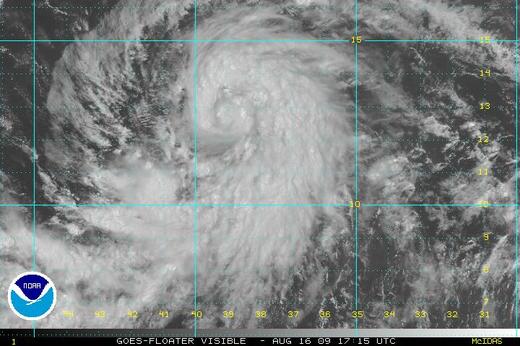
I’ve attached their final forecast discussion below. Two things to note. First, when they stopped their forecasting, Noel had already begun to take on non-tropical characteristics.

THE AIRCRAFT DATA ALSO INDICATED THAT NOEL STILL DISPLAYED A WARM CORE AND A FAIRLY TIGHT RADIUS OF MAXIMUM WINDS. SINCE THEN…THE INNER CORE CONVECTION HAS SUBSTANTIALLY DIMINISHED AND IS NOW INSUFFICIENT TO QUALIFY NOEL AS A TROPICAL CYCLONE. IN ADDITION…THE FSU CYCLONE PHASE SPACE DIAGRAM SUGGESTS THAT NOEL’S THERMODYNAMIC STRUCTURE IS BEGINNING TO BECOME ASYMMETRIC AND FRONTAL. THUS THIS WILL BE THE LAST NOEL ADVISORY.

Second, and much more importantly. Noel was going to get stronger!

BAROCLINIC FORCING SHOULD FURTHER INTENSIFY NOEL AS AN EXTRATROPICAL CYCLONE AS IT ACCELERATES TOWARD THE NORTH-NORTHEAST. ALL OF THE GLOBAL MODELS BOTH DEEPEN THE CYCLONE AND EXPAND THE HIGH WIND AREAS.

From a purely meteorological standpoint, NHC was correct. Noel was no longer a tropical system. They cover tropical systems – period.

That misses the point. The Hurricane Center’s job is to protect lives, not be meteorological purists.

When they stopped issuing forecasts, advisories, bulletins and maps, the job moved to the local forecast offices, like Taunton, MA and Upton, NY. Those offices have very capable forecasters (some of whom I’ve known for two decades).

Again, that’s missing the point.

By changing Hurricane Noel to an unnamed extratropical low, NHC signaled a diminished threat to the untrained public. That just wasn’t so.

There is already enough concern for public perception that the term “minimal hurricane” is no longer used in public bulletins.

Public safety officers, emergency managers and even broadcast meteorologists know exactly when and where to get data on tropical systems. It is specific and very different data than any other forecast product we get. The data from the local offices is totally different.

In the case of broadcasters, we all have equipment which automatically produces maps as the Hurricane Center’s data comes in! When that stopped, the ability to produce the most compelling and illuminating maps stopped. These maps made the case Noel meant business.

Based on the response I received from the director, I wonder if a “Hurricane of ’38” scenario would also see the Hurricane Center back off!

Something’s got to be done. That’s the bad news. The good news is, these are very bright people. I hope they find a way to change their policies before someone gets hurt.

Continue reading “My Beef With The Hurricane Center”

Yikes – Dean Gets Stronger

Earlier this evening, around 8:00 PM, The National Hurricane Center issued a statement saying Hurricane Dean had top winds of 155 mph.

DEAN IS AN EXTREMELY

DANGEROUS CATEGORY FOUR HURRICANE ON THE SAFFIR-SIMPSON SCALE.

SOME STRENGTHENING IS EXPECTED LATER TONIGHT…AND DEAN IS LIKELY

TO BECOME A CATEGORY FIVE HURRICANE PRIOR TO MAKING LANDFALL.

About a half hour later, based on recon data, Dean was upgraded to 160 mph.

000

WTNT64 KNHC 210034

TCUAT4

HURRICANE DEAN TROPICAL CYCLONE UPDATE

NWS TPC/NATIONAL HURRICANE CENTER MIAMI FL AL042007

835 PM AST MON AUG 20 2007

DATA FROM THE AIR FORCE RESERVE HURRICANE HUNTER AIRCRAFT CURRENTLY

INVESTIGATING HURRICANE DEAN INDICATE THAT MAXIMUM SUSTAINED WINDS

HAVE INCREASED TO 160 MPH…MAKING DEAN A POTENTIALLY CATASTROPHIC

CATEGORY FIVE HURRICANE ON THE SAFFIR-SIMPSON HURRICANE SCALE.

$$

FORECASTER KNABB

There’s really no practical difference between 155 mph and 160 mph. Wind force increases logarithmically with the wind speed. But there’s a great perception difference, because at 160 mph, Hurricane Dean becomes a Category 5 storm.

Should Dean strike the Yucatan Peninsula as a Cat 5, it will be the first Atlantic Basin Category 5 landfall since Andrew, 15 years ago!

The only good news is, Dean will be sufficiently south of Cancun to produce less damage than a direct hit. It’s still going to crush the region mercilessly.