Storms At The Hurricane Center

It looks like the boss is starting a paper trail on National Hurricane Center Director Bill Proenza. When Proenza criticized NOAA’s budget for anniversary celebrations, saying it was taking money away from a satellite project that affected accuracy… I think that’s when we entered the “don’t get angry, get even,” stage of employment.

I don’t know much about Proenza, but what I’ve heard has been positive. Coming to run NHC from elsewhere in the Weather Service must be tough. It is, by far, the most visible job in the Weather Service.

There is incredible pressure to forecast at levels beyond our present scientific capability. Wouldn’t that be the definition of pressure?

While all this tumult is going on upstairs, downstairs at least one forecaster seems to be throwing Proenza under the bus. This is from today’s Miami Herald in an article titled, “Pressure builds for storm chief” :

Meanwhile, for the first time, one of Proenza’s hurricane forecasters expressed public concern about some of Proenza’s actions since he took the job in January.

Lixion Avila, a lead forecaster and a center employee for more than 20 years, said he believes Proenza meant well but unintentionally has undermined public faith in hurricane forecasts.

Avila goes on to blame Proenza for something Avila acknowledges isn’t what was actually said. It’s getting messy.

Is this jealousy from a PhD whose boss is just a mister? It wouldn’t be the first time. Most of Proenza’s lead forecasters do have greater academic credentials than he does.

June and July, though part of the hurricane season, are normally quiet months in the tropics. It’s not until mid-August that things begin to get busy. I hope, by then, the Hurricane Center will be able to concentrate on hurricanes.

Yesterday’s Weather Fears

I’m never happy to be right about severe weather. The storms came yesterday afternoon under that ominous “Tornado Watch.”

Let me pause for a moment. A little tangent.

The Weather Service has watches and warnings and advisories. There are too many descriptions for too many different events. It is confusing to the public, in spite of the fact the whole idea is to inform the public.

Last night, by storm’s end, over 50,000 customers were without power. That’s a misleading number, because of home (one customer) might contain four or five or more people. There were tree down all over the place.

I started getting emails with tornado claims. There’s really no way to tell unless you’re in a Kansas type situation where the tornado is ‘in the clear’ and easily seen. We don’t get that here.

Early in the afternoon, as I’d gotten ready to go on for a quick live report, our director had pointed to an image on one of our remote cameras. It looked like a funnel.

I quickly made the decision not to mention that. I couldn’t be sure what it was from our distant camera shot and it wasn’t reaching down toward the ground.

More importantly, I thought the verbal warnings and instructions I was giving would have been proper in a tornado and there was no reason to cause panic.

Should I have mentioned the funnel? Based on what I knew then, I still think I made the right decision.

Now I have more information.

That photo on the left came via email from someone name Ted in Milford. Though I’d normally enhance a shot like this to bring out the contrast, this is ‘as is.’ It looks like it was shot through a window, hence the reflection of a fluorescent light fixture on the right.

All the experts who’ve seen it say it’s a funnel cloud. A tornado is a funnel cloud that reaches toward the ground. This was close and could have grown to be one.

After a day like yesterday, I usually look back to think about what I did and said. I wasn’t perfectly smooth – but who ever is? I think my info was good and appropriate and I respected the fact that every time I came on, I was interrupting someone’s viewing.

My job is to prepare the viewers, not panic them.

Greetings From PBI

Our flight was scheduled to leave at 2:55 PM. Now it’s on the board for 3:15 PM. It makes no difference. We were here early anyway.

As we passed painlessly through security, I had an overhead announcement making the last call for a Southwest flight to Tampa, Phoenix, Las Vegas and Sacramento. That’s a lot of peanut and Diet Coke time between here and Sacto.

We’re at Gate B5, which isn’t a particularly long walk. Helaine found a seat right away, but I staked out our position in the Group “A” line.

Southwest doesn’t have reserved seats. As you check in, you are assigned a boarding group – A, B, or C. But, all A’s are called together, so one of us (that normally means Helaine) usually gets in line. Today it’s my turn.

The line for Group “A” is behind the check-in podium facing a bank of now removed payphones. The good news is, there are power outlets here. Good for me, with a laptop who’s battery stamina is measured in seconds.

What’s bad is, I’m sitting on my tush and this floor is very hard.

Someone just walked up to ask if this is the line for “A.” Yes. That’s the fith time this question has been asked.

With so many people in close proximity, there is no privacy. I’m listening to a guy right now having a business conversation on his cell phone. A few minutes ago a woman checked her messages using the speakerphone feature of her cellphone!

She quickly hit the switch when a message came in telling her the person speaking was in withdrawal and needed her help. Honest.

I took a look at our flight’s data on FlightAware.com. As I was looking, a woman nearby asked if there were weather problems on our route. I quickly called up the Weather Service composite radar for the US. No problem. She thinks I’m a road warrior god.

I expect Southwest will make up any delay during our stopover in Baltimore. We’ll be home later this evening.

This was a very short trip to Florida, but I’m glad we made it. It was nice to see them. Nice to hang out with them. Nice to leave before we wore out our welcome.

It’s Critical

There are some things the Weather Service does very well. For instance, if they’re going to make changes to computers or systems, they won’t make the change if the weather is overly harsh. You don’t want Hurricane Zeyde steaming toward shore only to discover the new computer warnings aren’t working.

I’ve watched this policy at work for years, successfully. These periods of concern are called Critical Weather Days

NCEP Critical Weather Day Status

Critical Weather Day is in effect.

A Critical Weather Day (CWD) has been declared due to a request from headquarters . This CWD is valid from 06:00 UTC 1/23/07 until 10:00 UTC 1/24/07.

And the emergency is….. drum roll please… The State of the Union Address. No kidding.

Maybe this has happened in the past, but I’ve never heard of something like this making the Critical Weather Day list. I’m not saying it’s wrong – just weird.

Working On Vacation

I had my car washed today. It’s not that it was dirty as much as I wanted it to be clean! I was going to a meeting with my weatherboy peeps and this is as close as I get to ‘dress to impress.’

All things considered, I should have taken a pass. I’m on vacation. However, the guest of honor was Walt Drag. That changes everything!

I’d better explain. In the weather world, even when you don’t use the Weather Service forecast (and I don’t), you still read the Weather Service discussions. They are heavily technical and go deep into the thought process of the on-duty NWS lead forecaster.

They’re fascinating and insightful and loaded with enough abbreviations to make them nearly unintelligible to casual readers. Walt Drag is the Steven Spielberg of the forecast discussion!

Walt was coming with Nicole Belk, a Weather Service hydrologist (think flooding). Together, they were presenting a rundown of changes and highlights at the Weather Service.

Since the Weather Service office that serves most of Northern Connecticut is in Taunton, MA, and since 20 local meteorologists were expected, Walt and Nicole came to Connecticut. Brad Field at Channel 30 volunteered their studio as our lecture hall.

That was pretty nice. That WVIT sprung for sandwiches was even nicer.

In 23 years in Connecticut, I’d never been inside of Channel 30. In fact, though I’d seen the building from the Interstate, and knew its address, I couldn’t find it until cruising through the neighborhood a few times.

It was nice to see ‘the guys.’ Other than Nicole, all the local mets attending were guys. Some I hadn’t met before. Some I hadn’t heard of before. A few were really young – I hate that.

I tend to be a pain-in-the-butt at times like this, and today was no exception. I have a huge beef with the Weather Service, and I got it off my chest again.

Though I don’t use the NWS forecast, I do try and use their watches, warnings and advisories. The problem is, there are three Weather Service offices that cover Connecticut. Each serves a small slice of the state and is quite parochial in its outlook.

There’s no easy way to explain this, but sometimes using the watches and warnings from all three offices would be misleading. That’s especially true during winter weather situations.

There needs to be a lot more coordination than there is now.

Brad said he sometimes changes what’s issued, so it makes sense – even though he’s putting words in the NWS’ mouth. I do the same thing. We can’t be alone.

Unfortunately, I’ve been bringing this up for as long as I can remember. And, obviously, I haven’t had a lot of impact.

It’s a shame, because in the long run, it’s the general public that gets under served because of this situation.

I did learn a lot from what Walt and Nicole presented, which was good. It was also a lot of fun getting to see all those people I usually only see on TV.

Oh – it was also good to finally see what Channel 30 looks like.

I’m On Hold

Weather is a traveler’s enemy. And, when you forecast the weather for a living, you can sometimes see the enemy vividly, even from a distance. That’s the case today, looking at tomorrow.

I’m writing while on hold with Southwest trying to change our tickets.

Here’s the official Weather Service forecast. I normally don’t use the Weather Service, but this is ‘informational purposes only.’ There’s not much they’re saying I don’t agree with.

Tuesday: Periods of snow and sleet. High around 31. Blustery, with a north wind between 20 and 25 mph. Chance of precipitation is 100%. New snow accumulation of 7 to 11 inches possible.

Tuesday Night: Periods of snow possibly mixed with sleet, mainly before 9pm. Low near 26. Blustery, with a north wind between 17 and 22 mph, with gusts as high as 33 mph. Chance of precipitation is 80%.

Our cruise leaves Wednesday. Our reservations to Los Angeles are for tomorrow. Miss the flight, miss the cruise.

It’s likely our plane will be canceled or delayed (and we have to make the last connection of the night in Baltimore). All the flights for Wednesday are already booked solid!

I have just convinced Southwest to let us leave today… sort of. We’ll spend the night in Baltimore and spend tomorrow night in Los Angeles before boarding our ship.

Can’t stay. Must pack – quickly. Will explain later.

Hurricane Gloria – 20 Years Ago Today

I came to Connecticut in May 1984. I thought I did a good job on the air, but being a little over-the-top was the only way I stood out from my competitors.

All that changed September 27, 1985 when Hurricane Gloria made landfall in Connecticut.

For me, it was a career changing event. It was a chance to let people know, though I might screw around when the weather was nice, I was trustworthy when weather was critical. At least that’s how I saw it.

1984 doesn’t seem so long ago, but it was eons ago in technology and forecasting technique. The possibility of this hurricane came up in a conversation five days before landfall. A friend noted an interesting system and some rudimentary computer guidance brought it vaguely up the coast.

As I remember it today, each successive day continued with the storm on a fairly consistent track.

Looking back, I realize I was a sucker. These forecasts were well beyond the capability of the available models. That they were right was dumb luck!

A few days before Gloria struck, I started sharing my concerns with my boss and he put together a plan. Again, in hindsight we were so innocent. Today, wall-to-wall coverage would begin days before the storm struck. In 1985, with the storm due midday, we planned on running Good Morning America in its entirety!

I stayed after the late news, doing cut-ins through the night. No one was watching, but I was there.

We had little morning news presence back then. I don’t even remember who it was, but a single person produced and reported in the morning.

At 7:00 AM we switched to GMA. Every half hour their meteorologist reported the national weather, including the upcoming hurricane. The graphics on GMA were wrong&#185. Every half hour I’d follow Dave Murray, asking the viewers to believe me and not him.

Before long, we were on-the-air non-stop. The station really did an amazing job. I still remember some live shots, especially David Henry’s from Bridgeport, as if they happened yesterday.

Gloria had been a Category 3 hurricane with 125 mph winds, but was a shadow of her former self when she hit Long Island and then Connecticut. Officially, Gloria hit Connecticut with 90 mph sustained winds. Today, I doubt even that number. Whatever it was, it was frightening. Half the state lost power.

My friend Diane Smith lost a beautiful sailboat. Other friends and co-workers would lose trees and power – in some cases for a week or more.

I watched the storm on the Weather Service’s ancient radar. As it approached Connecticut, the eye opened up. We had one eyewall pass overhead and that was it. The southern half of this north moving storm no longer existed.

By nightfall Gloria was gone and Connecticut was picking up the pieces.

A day or two later in the New Haven Register, Carolyn Wyman didn’t talk about my coverage, she wrote about my disheveled hair, wondering if it was an affectation. I was crushed. I wonder if Carolyn (who seems like a nice person) knows I still remember? I wonder if she still feels that way?

On second thought, maybe I don’t want to know.

Hurricane Gloria was where I first realized, no matter how important it made my job, I didn’t want really bad weather to come here. Some forecasters do. Some meteorologists salivate over tornadoes and hurricanes. I, on the other hand, had my fill on that one day.

Years later, Governor (now prisoner) John Rowland told me he was waiting for houses to start blowing through the streets of Waterbury. To some, the storm was a disappointment. To others, especially along the Connecticut shoreline, it was a few hours of terror.

I am looking forward to seeing some of the old video and trying to remember what it was like watching it the first time. I am petrified that among the old clips will be a little cut of me, 20 years younger, looking like I was 15.

&#185 – As far as I could tell, a graphic artist preparing the maps traced the correct forecast track. Unfortunately, the line she/he drew wasn’t centered on the pen, but was actually to the right of it. That was common back then.

The More I Watch, The More Unhappy I Am

Hurricane Katrina ceased being a weather story days ago. I now watch as an interested bystander. I am very unhappy with what I see.

If FEMA or any other part of Homeland Security has had an impact on those people in New Orleans and the Gulf Coast, I haven’t seen it. Again, this storm wasn’t a surprise. I told people here in Connecticut how bad I thought it would be… but I wasn’t alone.

Reading the pre-Katrina statements from the Weather Service’s New Orleans office, there was no doubt this was being portrayed as a killer… a once in a lifetime type event. The Hurricane Center was saying the same thing.

Where was FEMA?

Where was Homeland Security?

Where are they today?

How can we allow our fellow citizens to suffer, as these people are certainly suffering? Where is the humanity that symbolizes America? These poor citizens deserve comfort.

New Orleans is a city filled with poor, black people. I would be easy to think this was racist or classist treatment. I don’t think so. I think this is a case of inept agencies. They would have poorly served any group so affected, regardless of station in life.

It looks like there are still people dying from this storm. How disgusting is that?

From the New Orleans Times-Picayune:

Burying The Lead

There is a phrase used in journalism when you take the most important part of a story and overshadow it with something less important. That’s what’s going on with the Weather Service’s forecast for New Orleans.

Monday: Occasional showers and possibly a thunderstorm, mainly after 1pm. High around 85. Windy, with a east wind between 65 and 70 mph becoming calm. Winds could gust as high as 100 mph. Chance of precipitation is 90%.

Occasional showers and possibly a thunderstorm. Hello? You’re forecasting a hurricane for heaven’s sake. And, you’re forecasting it in, arguably, the most susceptible place in the country.

In the forecasters defense, what you read is a product of a semi automated process which puts words to forecast parameters… still. This way a forecaster can write lots of different pinpoint forecasts based on wide area information.

Let me use that word again… still!

Hurricane Katrina has strengthened, but not as much as would be anticipated. There are odd signs.

IT SHOULD BE NOTED THAT THE MAXIMUM FLIGHT-LEVEL WINDS REPORTED BY AIRCRAFT SO FAR ARE 106 KT…WHICH ARE LOWER THAN WOULD NORMALLY BE EXPECTED FOR A 940 MB HURRICANE.

All that aside, conditions in the Gulf are so strongly favorable for development that short term fluctuations or even developmental weakness should be disregarded. At least that’s how it looks this morning.

It’s always possible, after the fact, things like the flight level wind will be looked at as a sign we saw and missed.

There’s not much surface data coming in now from the area near Katrina. The highest wind I can find is ‘only’ a 45 knot (about 52 mph) gust at a buoy (the 30 foot tall one in the photo on the left) located about 300 miles south of Panama City, FL. The buoy is rolling in 25 foot waves, in the 86&#176 water.

Right now I’m scared for New Orleans.

It’s All Over In Birmingham

I’m sitting in a corner of the lobby of the Radisson Hotel in Birmingham typing this blog entry. Most of my classmates have gone home or gone to lunch. As a chronic snacker, I’ve already had my fill.

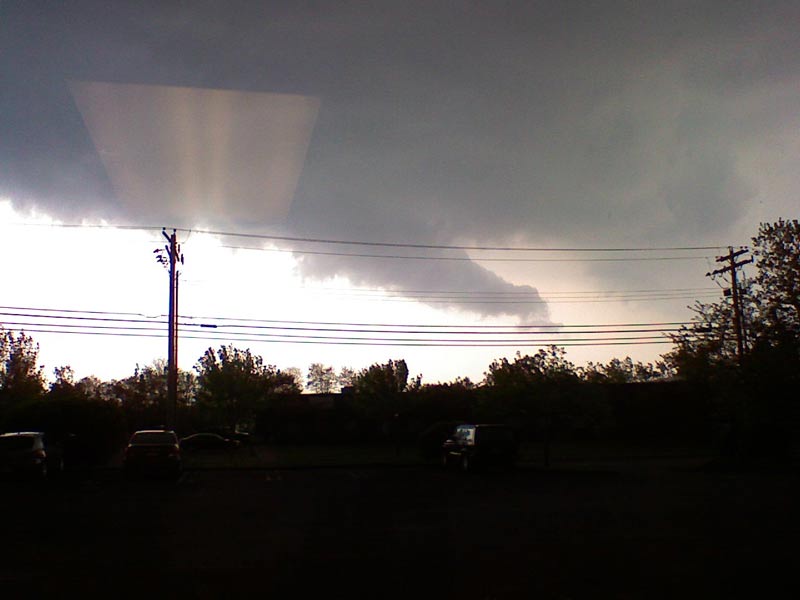
We spent all day Friday seeing presentations and lectures. There were a few given by Weather Service personnel from here in the south. What they said was fine, but it was really about types of weather I just don’t deal with… and never expect to deal with.

Later, one of the Mississippi State instructors presented a case study for us to analyze. Again, it was interesting, but it dealt with a type of storm we never see in the east.

Finally, as the afternoon was ending (it was actually evening by then), we began another session of tape watching.

While it was going on, I thought I was the only one dreading this. Later I found nearly everyone was self conscious and petrified of what their classmates would think.

Isn’t strange how we can go on the air, in front of thousands (sometimes millions) of viewers without a second thought. But, to show our work in front of a room full of our peers is a weak kneed moment!

My tape was pulled. I stood up to say a few words before it played. I attempted to crack a small joke at my own expense. Silence. Tough room.

The tape played and I was really squirming. I think it was OK and, of course, the polite comments were very nice. Who can really tell?

What impressed me more than anything were the few people who had no background in broadcasting or weather, adults who had decided to begin a new midlife career and registered for the MSU program. A few of them were the program’s best students.

The session ended around 7:30 and I headed to the room. I was fully intending to stay there for the rest of the evening until I called Helaine. She accused me of acting like an old person. I was in Birmingham. Have a good time.

I changed my shirt and headed to the lobby.

A few groups were organizing, deciding where to go. I joined a group of 14, and we headed to Ruth’s Chris Steakhouse.

Correct me if I’m wrong, but there’s no way to say this restaurant chain’s name without sounding like you’re mispronouncing it.

We entered the restaurant and were escorted to a small, private room. That was perfect, because we didn’t want to disturb the other diners, and we certainly didn’t want them to disturb us!

I had lamb chops and broiled tomatoes. The chops were beautifully seasoned, thick and very tasty. I started to explain to the waiter how I wanted them cooked. He just looked at me and said, “Pittsburgh?”

Exactly, Pittsburgh. Some burn on the outside, but more medium in the center.

We left the restaurant and headed back to the hotel. On the way, some decided to go to Danny’s, a local bar. This time I took a pass and continued to the Radisson. There was, after all, another morning of class to come.

I have been getting up very early (for me) on this trip. Even though my commute was by elevator, I was still out of bed by 7:30 AM. That’s just wrong.

Today was the final session. A practice test&#185

Hold on… cell phone. Uh oh! Words I never want to hear.

“Hello, Mr. Fox. It’s Mary from Delta Airlines calling.” This is not a social call. “Unfortunately, your flight from Birmingham to Cincinnati has been canceled.”

This blog entry will be picked up when I get back to Connecticut.

pause

Where were we?

In order to successfully finish the course, you need an 80 on a two hour, 100 question comprehensive test. It covers all three years. How could you possibly study?

On the other hand, the instructors have told us 90% of those taking this test pass on the first try. People with A’s and B’s always pass the first time.

I took the sample test. The benchmark was 55 answers correct on this shortened test, to pass. I got 54 right! Better luck next time.

As I checked around the room I realized, I wasn’t alone. This test might have been a little harder, and it certainly wasn’t an open book test, as the real one will be. On a test like this, where I’ll probably know 75% of the answers immediately, open book will be the difference.

There were also awards handed out. I did very well at MSU and was thrilled to receive, along with six others, an award for academic excellence.

You may have noticed, as the photographer, I’m not in many pictures. Well, for this award I handed the camera to another student and walked to the front. At least this one achievement should be documented.

That is how the photo came out of the camera!

Even more impressive, a few of the awards were captured by people who had never been on the air! This course was their first meteorological experience and they scored all A’s. That’s astounding.

We finished off our sessions with a talk about the qualifications for the American Meteorological Society Broadcast Seal. The AMS is transitioning to some new criteria for the seal. In fact, though I’ll be grandfathered in, it’s obvious the AMS is trying to diminish the Mississippi State program in favor of four year, calculus based degree programs.

It’s ridiculous, because the MSU program is more than sufficient for an on-the-air forecaster. It seems to me, this is only a way for the ‘traditional’ on-campus meteorology programs to avoid competition.

The AMS is also starting a Certified Broadcast Meteorologist program, which I will not qualified for! I didn’t have meteorology classes that were calculus based. Of course, no one in operational meteorology ever uses any calculus to produce a forecast!

Angry? Me? Sure – a little bit. I knew all of this going into the AMS program. It’s the meteorological equivalent of a protective tariff.

So, that’s it. The program’s over. I have not yet taken the comprehensive test, but my instructor instructed me to begin referring to myself as a meteorologist… and I will.

And then, that phone call from Mary at Delta!

We spoke for a few seconds, and things didn’t sound promising. Then, I said I’d be willing to fly to Hartford and have Helaine drive me to New Haven to pick up my car.

Perfect.

Delta would move me to an earlier Birmingham to Cincinnati flight and then take me to Hartford. I’d be over 50 miles from my car, but I’d be in Connecticut three hours earlier than previously scheduled.

I packed up my gear and hopped into the hotel’s airport van. Three guys in airline uniforms joined me. As it turned out, they were my crew to Cincinnati.

We got to talking and before long I was asking them, then telling them about meteorology. The pilot, a kite surfer, was looking for a better way to predict ocean winds. I made a recommendation.

Later, during the flight, he congratulated me on passing my course on the plane’s PA system. How embarrassing.

So, now I’m home. I’m really tired, but I’ll be better tomorrow. Going to Birmingham turned out to be a better, more valuable trip than I anticipated (not that I had any choice in going)

&#185 – Even though I have totally completed the course of study, there is a comprehensive test of 100 questions in two hours that I’ll have to take within the next few weeks.

Thunderstorms And Weathermen

From the time I woke up today I was consciously checking the radar, looking back every so often to track storms in Central New York State. They were where I expected them to be. The computer guidance implied they would fizzle as they approached Connecticut.

That kind of advice is mostly good, but you can’t let your guard down. Tonight was a prime example.

As the storms rolled out of the Catskills and into the Hudson Valley they were still intensifying. I spent significant time on them during my trips to the weather wall. As we approached 6:30 PM it became obvious they would still be a threat as they entered Connecticut.

It’s interesting, but I adopt a different persona when the weather demands real time action. You know the phrase, “it never rains, it pours?” That applies to weather. It either easy or nerve wracking. There is no middle ground.

As the news ended, I went to the ‘back’ and gave our engineers a heads up. There might be a Severe Thunderstorm Warning. I wanted it on quickly. Advance planning helps in that regard.

Within five minutes the Weather Service began to issue warnings. First Litchfield, then Fairfield then Hartford County. Over the next forty five minutes they were all lit up on the map at the top of the TV screen.

I have to make an interesting decision under these circumstances. Does the warning stay up 100% – even through commercials? These storms looked pretty potent, so I said yes.

It’s interesting to note that these warnings came without benefit of a Severe Thunderstorm Watch – the Weather Service’s equivalent of a heads up. Sometimes I think they are too caught up in what has been forecast and don’t pay enough attention to what’s actually going on. Just my opinion.

I spoke to our promo producer, making it clear I wanted all the time on our 7:22 live cut-in. Then I went to engineering to see if there were any promos that could be cut, allowing me to extend my time. What was scheduled for 35 seconds became :50. It doesn’t sound like much, but that’s a major help.

Going on the air during a severe weather situation can’t be taken lightly. I don’t.

I worry about all the people I’m scaring. I worry I won’t properly communicate the gravity of the situation, letting some people poo poo what they’re hearing. I worry about people outside the warning area who are ticked off at me for cluttering up the screen or interrupting programming (which I didn’t have to do tonight).

So far things have gone well. A few small pieces of equipment didn’t perform as expected. It wasn’t something a viewer would have noticed, just a little extra feature I wasn’t able to use. I tried working with the tech support people to correct it, but decided to wait until after the storms have cleared.

Having more toys, more capabilities, has actually made my job tougher. There is more I can do to get out the word and get it out faster. That will be my challenge this summer. Tonight was a good first step.

My heart is still pounding a little harder than usual.

There’s a weather bulletin board I check in on from time-to-time. Lots of the participants salivate waiting for strong storms. I don’t get it.

Housatonic River

We had horrendous rains today – thankfully less than I expected. Still, rivers are running high.

During a lull in the action, a viewer was driving through Cornwall and got this shot. The river is very high… and there was heavy rain after this video was shot. Earlier, flooding was expected to be severe, but the Weather Service cut that back to moderate.

It still looks pretty scary.

I can’t show this on the air, so I thought I’d show it here.


Connecticut Snow Totals

This seems to be a question of general interest. How much snow did Connecticut get? The Weather Service, since their switch to automated readings, has become less helpful in this regard. However, the Connecticut Department of Transportation does keep good records of each snow storm.

Blogger’s note: This entry first ran in 2005. It gets found again each winter. In February 2008, I updated the snowfall link to CT DOT which seems to change on a yearly basis. Now, in February 2010 it’s changed again!

This seems to be a question of general interest. How much snow did Connecticut get? The Weather Service, since their switch to automated readings, has become less helpful in this regard. However, the Connecticut Department of Transportation does keep good records of each snow storm.

Here’s the only problem: DOT clears the recording area and starts fresh for each reading. That gives higher totals than standard readings because there is much less settling in the DOT method. However, it’s the best, most consistent source.

Any port in a storm, I suppose.

Snow – A Little Easier To Take

For Valentines Day, I brought home some daffodils for Helaine. It was Sunday night and I walked into the darkened house carrying what looked like a few dozen asparagus stalks.

The daffodils bloomed and I think they’re beautiful. Their yellow is so bright and so different than the winter outside. Spring will soon be here – not a moment too soon.

This has all been pushed to the foreground today because it snowed overnight. I haven’t looked at the official numbers&#185, but judging by the emails I’ve received, my call last night was pretty close.

As much as I dislike snow, getting it right is a mitigating factor. It makes the whole storm a little easier to take.

Soon, I’ll be driving back to work. Roads will be slippery. Judging from my driveway, by late tonight much of Connecticut will be covered in black ice. Helaine will be worried, and I worry about her angst.

Like I said. I like daffodils. They stand for everything good that’s yet to come.

&#185 – Actually, the Weather Service no longer puts out official numbers on an hourly basis from airports. We are dependent on the Connecticut DOT, who does measure the snow, but does it in a way that tends to overestimate the results (they clear an area and start fresh each few hours). At least they are consistent, which is much more than half the battle.

The Humanless Weather Forecast

There’s a storm coming, beginning tonight. It’s a forecasting challenge and I’ve really sweated this one. Depending on where in the state you are, you will see radically different weather.

Normally, I don’t second guess myself by looking at the competition&#185. But, this morning when I woke up, as I was tuning around on the TV, I hit the Weather Channel in mid-forecast.

I’m sure this isn’t what they meant to put on the screen. It is what you can get if there aren’t actual humans watching what goes out on the air… and with their local forecast, there aren’t people watching at the local level.

I feel bad for their viewers who tuned in to see the forecast.

&#185 – Maybe this statement isn’t 100% true. I do read the Weather Service’s technical discussions which are often very well thought out, insightful and hint at what their actual forecasts will say. I seldom see the forecasts themselves.