If You’re Wondering How Much

As if looking out the window isn’t enough the isopleths on this map show Western Connecticut and Buffalo have comparable snowfall totals.

This morning’s Times had an excellent graphic showing the extent of this winter’s exceptional snowfall (Note: I am not using exception quite the same way it’s used in: “Billy is an exceptional student and will surely win a scholarship to Yale.”). As if looking out the window isn’t enough the isopleths&#185 on the map show Western Connecticut and Buffalo with comparable snowfall totals.

Oh the humanity!

Officially Bridgeport has 54.2″ so far while Bradley has 71.1″. Your actual mileage may vary.

&#185 – iso·pleth (ī′sō plet̸h′, -sə-) noun –The line connecting points on a graph or map that have equal or corresponding values with regard to certain variables.

There are many ‘iso’s we learned about in school: isobar, isotherm, isodrosotherm, etc. When there is no specific ‘iso’ to cover a situation (or I don’t know it) isopleth is used.

Snow: Not Yet A Fond Memory (photos)

Here are three shots with which to remember the day… if you really want to.

Some day today’s weather will be a fond memory. Not yet! The snow came as a surprise this morning; an appetizer if you will. The main course comes tonight.

Where are we going to put it all?

The snow on my deck furniture is higher than I’ve seen in twenty years. If there’s a way to get out there to take a photo I would. There is not. For now you have to take my word. I opened a side door briefly to get a shot of the snow piled on the grill. No barbecue tonight!

The good news is my skills as a snow photographer have definitely improved! The bad news is who exactly wants that skill?

Here are three four shots with which to remember the day… if you really want to.

Ice, Baby

Meanwhile, while all this scary stuff is going on the overall view is amazing. Nearly all our trees are fully encased in ice!

I opened the door and poked my head out. It’s cloudy, 34&#176 and nearly calm. It sounds like it’s raining. That’s the sound of icicles melting and dripping!

We’re finally getting to survey our surroundings in the light-of-day. It is at once beautiful, overwhelming and a little frightening.

Last night I wrote about our “U” shaped tree. How much longer can it hold that position before it snaps?

The powerlines are sagging under the weight of the ice. They’ve held so far which implies they’ll continue to hold as the weight lessens. If the wind kicks in all bets are off.

My driveway is coated in ice. There are a few puddles, but even they are just hiding more ice. I’m driving Helaine to the supermarket in a little while and I expect parts of the trip will be white knuckle..

Meanwhile, while all this scary stuff is going on the overall view is amazing. Nearly all our trees are fully encased! This is not unheard of. It just doesn’t happen often and when it does the ice doesn’t last this long.

With all this icing it’s easy to miss the snow which fell by the foot while we were away. Snow settles over time. Piles naturally get smaller even without melting. That makes what I’m seeing even more impressive.

Less than 24 hours ago I was standing next to the “too hot” complaining woman at LAX. I’ll bet she wouldn’t trade.

Homeward Bound

Yes, I know what’s going on back in Connecticut.

It’s a sunny morning in the Southland. We’re at a hotel down the block from LAX. Helaine just watched a plane fly between two buildings!

Things are fluid. Our flight was scheduled for 12:55 PST. Now it’s scheduled for 2:05 PM.

Yes, I know what’s going on back in Connecticut. There’s freezing rain&#185 falling across much of the state and it’s falling on top of snow.

I’ve checked the computer guidance and temperatures should be mild enough by arrival time tonight. Unfortunately the computers are often too generous in pushing in warmer air under these circumstances.

Our plane stops in Nashville before going on to Bradley. I’d rather not spend the night there.

&#185 – Freezing rain falls when cloud temperatures are warm enough for rain. Drops fall in liquid form, but freeze on contact as they hit the ground, tree limbs, power lines, etc. It’s probably the most dicey weather for any time of travel–worse than snow.

Tonight’s Snow: Slippery When Beautiful

know, I’m not a snow lover. Gorgeous snow seems so out of character for me.

Let’s change the subject for a while.

It snowed today. Much of the heavier snow came this afternoon and evening. It was a wet snow–a strange way to describe something that’s 100% water! It fell with the wind nearly calm.

There were two significant results from that setup. First the roads were a mess!

The wet snow signified critical temperatures near the melting point. Warm tires against wet snow equals an icy slush between you and the road and zero traction. Some drivers found out they had four wheel drive and no wheel stop!

Second, it was gorgeous!

I know, I’m not a snow lover. Gorgeous snow seems so out of character for me.

Snow that would usually be pushed to the ground with the slightest puff of breeze stayed put. The wet flakes slowly drifted down and accumulated on unlikely spots like branches. Everything is coated.

Tomorrow when the Sun comes out the treebound snow will melt. Beauty is transitory.

Anyone Sick Of Winter Yet?

When snow approaches people want to know as much as we know even when we don’t know all that much!

Over on Twitter the ‘house account’ for the Meriden Record-Journal newspaper just tweeted, “Reports of snow possible towards the end of the week/weekend. Anyone sick of winter yet? #ctweather”

It didn’t take long to see a reply, “I am sick of winter and you can quote me!” That was from me.

Not even two weeks into winter officially and it’s already like being on a bad blind date looking for a strategy to bail. I need a winter wingman!

We’ve only had one real snowstorm so far, but this has been the windiest winter in a long time. December was a decidedly cold month–colder than even December should be. Now there’s the chance for snow as we head into the weekend.

Here’s one thing last winter taught me: Don’t commit too far out!

It’s OK to say what looks likely, but foolhardy to make that anything more than an advisory for planning early on. If you say something will happen with certainty you will certainly be burned! I still have scars.

120 hours out an error of a mile an hour (or less) can be the difference between heavy snow and no snow! I’m not that good. No one is.

I got a note from Dr. Mel this morning. We often chat when these larger systems approach. It’s good on both sides because speaking your mind and defending your ideas is as helpful as listening!

WE HAVE NOT ONE BUT THREE DIFFEENT CIRCULATIONS TO WATCH FOR THE END OF THE WEEK…

BUT IT IS ANYONES GUESS FROM THURSDAY NIGHT ON. THE KEY WILL BE THE TROUGH LINE. AS LONG AS IT IS SOUTH OF THE AREA, A CHANNEL FOR ATLANTIC MOISTURE WILL EXIST AND WE COULD GET BANDS OF MOD.SNOW IN THOSE SPOKES.

AS USUAL ALL THE MODELS FLIP FLOP…THE 12 Z KEEPS THING POORLY ORGANIZED, AND SHIFT THE TROUGH LINE NORTHWARD…MUCH DIFFERENT FROM OO AND 06Z RUNS.

WE WILL JUST HAVE TO WAIT WATCH…I HEAR THAT A LOT LATELY

People have accused me (and I suppose all forecasters) of hyping these storms. Why? You are just as likely to watch if we claim honest uncertainty as divine insight!

When snow approaches viewers want to know as much as we know even when we don’t know all that much!

The Not Really A Blizzard Blizzard

Basically there was so much wind the snow was blown into drifts which had the effect of compacting the snow.

I am bushed! I know my job isn’t physical labor, but today it was very draining. I started around 1:00 PM and went until 11:35 PM.

A lot of people do a whole lot more. How do you do that?

From a meteorologist’s standpoint today was very interesting. I know now there’s no way I could have predicted snow accumulations accurately. I think most people caught on to that viscerally. Basically there was so much wind the snow was blown into drifts which had the effect of compacting the total.

This is one of those cases where one plus one doesn’t equal two! It was possible to have an inch of snow one hour, an additional inch the next and end up with under an inch of snow!

How many feathers does it take to fill a bag? Similar quandary.

The wind was… still is at this hour… crazy. We seldom get 50 or 60 mph winds, but we did tonight and they were widespread.

I spent the my time on the air telling people to stay off the roads, but by the time I left the building the snow had temporarily let up and I made a dash for the house in Helaine’s 4WD SUV.

I took city streets instead of my usual missile flight up I-91. The main streets were plowed but very slippery. Once I turned onto the squiggly road that climbs my hill things became a little more dicey. The last half mile to my house had no visible tire tracks!

By the way, I stopped the car to take these photos. With all of you at home stopping in-the-middle of the road was no problem. Thanks.

Actually, I take that back. At one stop I had a little difficulty regaining my traction. A quick shift to reverse and a few feet of rollback solved the problem.

We had blizzard warnings tonight and certifiably rotten conditions. What we didn’t have (as I warned in a post a few days ago) was a blizzard! The official parameters are so stringent I’m not sure we ever could!

Maybe blizzard needs to be redefined.

Sunday’s Driving Me Nuts

The NAM misses us entirely. The GFS brings a plowable, not back breaking, accumulation. The European model hints at Armageddon!

This Sunday storm possibility is driving me a little crazy… and by a little crazy I mean very crazy! Each succeeding run of the computer guidance just muddies the water more.

There was a time earlier this week when one model hinted at 2&#189 feet of snow! Six hours later 90% of that wasn’t coming.

Even now just a few days ahead when the models should be coming into alignment they are not. The NAM misses us entirely. The GFS brings a plowable, not back breaking, accumulation. The European model hints at Armageddon!

Who could possibly know?

Here’s the funny thing. Even a non-specific forecast is helpful. There’s something to be said about at least planning for a ‘rainy day.’

Oh, hell… rainy. I hadn’t even considered that until now.

The Giants Should Have Known

All week the forecast called for a chance of snow Saturday. By Wednesday it became “likely.

Just in case anyone asks the Minnesota snowstorm that took the New York Giants by surprise was well forecast. This is an embarrassment for the Giants and NFL and a pain-in-the-ass for everyone else.

All week the forecast called for a chance of snow Saturday. By Wednesday it became “likely.” Winter Storm Watches were issued Thursday. A Blizzard Warning was up on Friday.

At Dinner: The Snow Dispute

This is what happens when you allow San Diegans (San Diegites?) to move east where there’s actual weather. They just can’t handle it.

Here’s a little taste of tonight’s dinner. Ann, Noah and I were sitting together at the Greek Olive. We were at a window booth looking out into the parking lot.

Noah: Oh my God, it’s snowing!
Geoff: That’s flurries Noah.
Noah: No, look it’s sticking. It’s on the cars. That’s snow.
Geoff: Flurries.
Noah: No, it’s really snowing.

This is what happens when you allow San Diegans (San Diegites?) to move east where there’s actual weather. They just can’t handle it.

Basically tonight is like early October in Buffalo. Live with it.

The Bane Of My Existence: Snow

We probably don’t have much more than a quarter inch right now. What’s the bet that delays some schools?

It’s snowing right now. I’ve seen it with my own two eyes. The snow’s light, sort of like dandruff from Mother Nature. It’s still snow!

I’ve been spending less time downstairs and more upstairs recently. No food up here. Still I get hungry. It was on a foraging trip to the kitchen when I noticed something that didn’t look quite right.

A quick flip of the porch light showed there was snow and it was sticking. We probably don’t have much more than a quarter inch right now. What’s the bet that delays some schools?

I take solace knowing light snow was in the forecast when I left work Friday. I won’t be right for every storm. That’s my wintry fear.

The Buffalo Snowmap

Here’s a map from the Weather Service recounting this storm. The 1-3 foot area is only 12 miles wide! It’s not much more than 6-7 miles from three feet of snow to zero.

Earlier today I posted my Lake Effect snow story. If you read it one of the points I tried to bring home was how narrow these bands really are. Now documentary proof!

Here’s a map from the Weather Service recounting this storm. The 1-3 foot area is only 12 miles wide! It’s not much more than 6-7 miles from three feet of snow to zero.

Click the map to see a larger view.

My Lake Effect Snow Story

The best way to explain Buffalo’s lake effect snow is with a little story. It was the day Helaine and I got our marriage license. Because we were getting married in Pennsylvania we had to drive to Erie, PA.

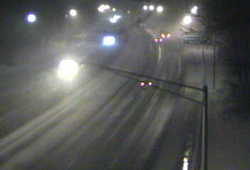
This evening at 4:45 the Weather Service office in Buffalo relayed a report from West Seneca, NY. A volunteer observer measured 32″ of snow from Thursday’s persistent lake effect snowband.

I wasn’t surprised.

Winter weather in the Buffalo area is brutal. The city itself gets ‘only’ around 80″ of snow per year. The snow belt south of town can get as much as 150″. East of Lake Ontario, closer to Syracuse, it’s even worse.

The area east of Lake Ontario is the “snow capital” of the east. The higher elevations between Watertown and Syracuse, commonly known as the Tug Hill Plateau, receives of more than 200 inches a year. In fact, the town of Hooker, located in Lewis county, recorded 466 inches of snow during the winter of 1976-77! – source: National Weather Service Buffalo Forecast Office

I lived in Buffalo from 1980 through 1984. I will never forget those winters. It seemed to snow nearly every day even if only flurries.

The best way to explain Buffalo’s Lake Effect snow is with a little story. It was the day Helaine and I got our marriage license. We were living in Buffalo. We were getting married in Pennsylvania. The closest place to get a license was Erie, PA, about 100 miles away.

As we left our apartment skies were cloudy. By South Buffalo there were flurries. We paid our toll and got on the New York State Thruway. We passed West Seneca in heavy snow.

I was used to Western New York driving conditions so we continued southwest on the Thruway paralleling Lake Erie’s shoreline. By Dunkirk the snow was back down to flurries. Soon we were in bright sunshine. I remember the skies over Erie being blue and cloud free!

We paid our money, showed our blood tests (another story for another day–blood tests almost kept us from getting married) and got our license.

As we headed back to Buffalo every bit of weather was in the exact same place we left it!

From Erie’s sunshine we hit flurries in Dunkirk. Over the course of a few miles the snow ramped up in intensity. It was snowing heavily as we passed through West Seneca then back to flurries by South Buffalo. I parked under cloudy skies back at our Gates Circle apartment where there was no sign any new snow had fallen.

That’s the power of Lake Effect snow: Persistence!

Lake Effect snow bands are often just a few miles wide, but within those few miles snowfall rates of 4 or 5 inches per hour are possible. The strength of cold air aloft and alignment of wind decides where the snow goes and its intensity. The wind needs a long ‘fetch’ over Lake Erie to be effective as a snow maker. That limits where Lake Effect snow can fall.

As long as the cold wind blows the snow can fall for hours or even days! A few miles often decides whether you get feet of snow or just a dusting.

There are only a handful of places in the world where this setup of cold air and properly aligned body of water exist. Buffalo and Syracuse just got lucky I guess.

Ask Me Anything–Most Memorable Storm

I spent hours on the air showing the radar, seeing the back end of the system and saying the storm would soon be out of the state. I did that through nine or ten additional inches of snow!

I’m currently answering all your questions. Read more about it here.

Eric asks, “Geoff, what storm in CT was the most memorable for you?”

Eric, you’d think it would be Hurricane Gloria. Maybe it should be. It helped establish a reputation for service in a tough situation. People saw me on-the-air for 24 hours straight.

Instead my most memorable was a blown forecast.

It happened well over twenty years ago. It was a snowstorm that wouldn’t end! I spent hours on the air showing the radar, seeing the back end of the system and saying the storm would soon be out of the state. I did that through nine or ten additional inches of snow!

As I would later understand the error in forecasting was mine. We had less guidance then, but I should have known. I’ve been through many similar storms since and understand the dynamics much better. In fact we had a similar storm this winter which was forecast well (though with some trepidation).

So, why is this one so memorable? It was the first storm where I was wrong and was punished by viewers. It took a few years before the ill will I acquired from that episode wore off. It was awful.

No one wants to get the grief I got over that one snowstorm. I certainly don’t.

What this storm did was help me understand how my work is being used. It was a lesson more forcefully learned in this storm than Gloria where I mostly got kudos.

It’s tough to explain because my attitude had never been cavalier. It just made me much more conscious of the utility of my work and the impact of my words. Twenty plus years later I think of that storm every winter and how to avoid a similar forecast disaster.

From time-to-time I’ll still blow a forecast. This past winter had a glaring example. It’s unavoidable when you’re predicting the future.

If you lived in my shoes you’d know how hard I work to avoid that. I’m not trying to set myself apart. I can’t believe anyone who does what I do feels any different.

There’s no upside to being wrong.

A Storm Unlike Any Other

I called and told him I was confused because I’d never seen this particular setup before. Neither had he!

dot greenwich camera.jpgEarlier tonight I took a quick look at one of the CT DOT traffic cameras on I-95 and gasped. The camera was in Greenwich-adjacent to the New York State line. While the rest of Connecticut was seeing moderate to heavy rain with temperatures mostly in the 40&#176s Greenwich had limited visibility with heavy snow. The snow had begun to accumulate!

dot westport camera.jpgA few miles up the road in Stamford there was nothing but rain! Even now, hours later, only the communities in Lower Fairfield are seeing the snow stick.

In retrospect the Greenwich blitz doesn’t change my forecast. It was scary to see–sure. The weather had done a rapid about face. It was all part of the forecast, but it happened so quickly and with such fury I was originally taken aback.

Let me qualify this because it’s easy to lose sight of what I’m talking about.

Something’s been falling from the sky since early Tuesday. One storm came and went. This is Part B of Storm 2. However, this unnamed¹ winter storm is so unusual scholarly papers will be written about it!

Thursday while Atlantic City was seeing snow Albany, NY was getting rain. Friday morning New Haven, CT will see snow while Bangor, ME gets the rain! Crazy.

90fbw.gifThe barometer is so low it’s approaching the range usually seen in hurricanes and tropical storms. We get pressure readings this low every decade or so.
Tonight, as the wind in New London shifted from east to southwest the temperature dropped 9&#176 in one hour! Cold air advection from the southwest! Isn’t that where warm air comes from?

Seriously–that’s nuts.

I called my weather colleague Dr. Mel Goldstein this afternoon. I’d developed my forecast but was unsure about one aspect. He’s a great weather historian so I called and told him I was confused because I’d never seen this particular setup before. Neither had he!

My concern was how much warm air would remain and how much water would stay on roads as the snow fell? How would this affect Friday? My guess is a great deal of the storm will just melt as it hits the pavement–not all of it. What does accumulate will be wet and sloppy and very heavy to move.

After Friday I’ll know better how my speculation comports with the real world. I am working totally in a theoretical world right now.
I am exhausted. This week has been a killer. There’s been no forecast where I could let up because they all were jammed with critical information.

Bring on the weekend.

¹ – As long as I’ve been in Connecticut WFSB has been naming storms. It’s probably a good promotional tool for them, but on those occasions when people refer to a storm by the WFSB given name I gag. These are people who also call the Fiesta Bowl the FedEx Fiesta Bowl.