Know Your Source

I feel awful for Mark Dixon and my other meteorologist friends at Channel 3. Here’s a taste of a story about a weather faux pas from today’s Hartford Courant:

False Alarm, Toto

Photograph Of Tornado Was Actually From Kansas, Not Thomaston, WFSB Says

By TRACY GORDON FOX And JESSE LEAVENWORTH

Courant Staff Writers

July 21, 2007

A photo of a Kansas-size twister that accompanied a TV news report Thursday about an outbreak of severe thunderstorms in Connecticut actually was taken in Kansas.

WFSB, Channel 3, received the photo by e-mail Thursday afternoon from a man who said he shot it on his father’s farm in Thomaston, station news director Dana Neves said Friday. The timing of the e-mail corresponded with radar showing severe weather over southern Litchfield County and ground reports of funnel clouds and a tornado in that same area, WFSB meteorologist Mark Dixon said Friday. The totality of the situation, he and Neves said, convinced the station that the photo was legitimate.

The photo was shown on the broadcast and displayed prominently on WFSB’s website, wfsb.com.

After verifying through the National Weather Service that the photo was shot in Kansas about two years ago, the station announced the mistake to viewers Thursday evening, Neves said. They also alerted federal officials.

I’m not saying it couldn’t have happened to me – because it could have. I tend to treat any kind of unsolicited video or eyewitness account with a grain of salt, but I’m not perfect.

Just to give you a taste of what goes on, here’s an email I received Thursday:

Hi Geoff–We had a tornado touch down in Thomaston and then again in Terryville–I don’t know about damage because I don’t live there. But local police saw it and reported it. Just thought you would like to know.

Sharon

I was so busy, I didn’t see this until long after the cell had passed through Thomaston. By that time, based on an NWS report, we had sent a reporter there. He found nothing.

I wrote asking Sharon where she got her info.

Hi Geoff–

I was watching the Weather Channel when I first got home and it came across in the National Weather Service Tornado warning on the bottom of the screen. It said the tornado was spotted by local law enforcement.

Sharon

Sharon didn’t mean to be bad or misleading. She was doing what she felt was right. But, she originally passed along second hand information as if she had obtained it herself.

I try my best to make personal contact with anyone who sends unsolicited material I use, but I know there are times I haven’t stridently followed my own rule. Speaking to someone usually provides to best clues to their trustworthiness.

This stuff happens all the time. Most of the time it’s a photo that someone claims comes from a friend or relative – but it doesn’t. I can’t tell you how many times I’ve seen the same bogus Katrina pictures!

There’s a larger point to be made here and that gets to the crux of citizen journalism. Are we ready to trust random members of the public to provide our news coverage?

Opinionated reporters (Bill O’Reilly, Keith Olbermann, Lou Dobbs, Brit Hume) may choose to report only certain aspects of a story, but you know where they’re coming from and can adjust accordingly. With random citizens, who knows what they’re trying to accomplish or maybe they’re too naive, like Sharon, to even know.

A good TV station, like WFSB, steps up to the plate and admits when they are wrong. That’s what good meteorologists and good journalists do.

On the other hand, when caught sending dubious material, I’ve found unsolicited citizen ‘journalists’ often stop responding.

This is the new world. There are aspects I don’t approve of.

Bad Weather Duty

A strong line of thunderstorms slid into Connecticut this afternoon. Though no ‘watch box’ was up first, the Weather Service issued a Severe Thunderstorm Warning, then Tornado Warning, in pretty rapid succession.

I was on the air within minutes of getting into the station. I didn’t even have time to tie my tie.

I spent two hours on-the-air, assisted by Matt Scott&#185 for a while, but mostly on by myself. That’s two hours of non-stop talking… or attempting to non-stop talk.

It’s very difficult. It was made more difficult since I had to both talk and operate my computers.

I don’t want to rehash much of the two hours, but I would like to tell you about one specific moment. It was more than a little weird. Eerie is a good descriptive word.

While tracking the strongest cell at-the-moment on the radar, I zoomed in tight. My map couldn’t have shown more than a few miles on a side. At that range individual streets show up as off-white lines on the otherwise Earth toned map. The radar echo returns were bright – the sign of strong downpours.

I clicked a few on-screen boxes and pressed the left mouse button as my cursor hovered over an unmarked street. The name popped up – W TODD ST. I looked at the map and briefly stopped my rhetorical conversation.

It was my neighborhood. I could see my street, not far away.

Helaine and Stef were watching at home. I later learned, when I talked about how strong this particular storm was and how I could actually see the street where I lived on this map, they headed to the basement.

It was an out-of-body experience to realize I had inadvertently stumbled upon a storm headed toward my home. How could I not pause for a moment to collect my thoughts?

There was some storm damage in Connecticut this afternoon and evening. A tornado is suspected in New Milford based on the damage and a spotter’s report of a funnel cloud. I passed some large downed tree branches on my way home tonight.

At my house, the greatest impact was a nasty leaky from our dining room skylight. Leaks can be fixed.

&#185 – Matt came in on his own, out-of-town friend and infant daughter in tow. I can’t tell you how grateful I am that he chose to help out.

Storms At The Hurricane Center

It looks like the boss is starting a paper trail on National Hurricane Center Director Bill Proenza. When Proenza criticized NOAA’s budget for anniversary celebrations, saying it was taking money away from a satellite project that affected accuracy… I think that’s when we entered the “don’t get angry, get even,” stage of employment.

I don’t know much about Proenza, but what I’ve heard has been positive. Coming to run NHC from elsewhere in the Weather Service must be tough. It is, by far, the most visible job in the Weather Service.

There is incredible pressure to forecast at levels beyond our present scientific capability. Wouldn’t that be the definition of pressure?

While all this tumult is going on upstairs, downstairs at least one forecaster seems to be throwing Proenza under the bus. This is from today’s Miami Herald in an article titled, “Pressure builds for storm chief” :

Meanwhile, for the first time, one of Proenza’s hurricane forecasters expressed public concern about some of Proenza’s actions since he took the job in January.

Lixion Avila, a lead forecaster and a center employee for more than 20 years, said he believes Proenza meant well but unintentionally has undermined public faith in hurricane forecasts.

Avila goes on to blame Proenza for something Avila acknowledges isn’t what was actually said. It’s getting messy.

Is this jealousy from a PhD whose boss is just a mister? It wouldn’t be the first time. Most of Proenza’s lead forecasters do have greater academic credentials than he does.

June and July, though part of the hurricane season, are normally quiet months in the tropics. It’s not until mid-August that things begin to get busy. I hope, by then, the Hurricane Center will be able to concentrate on hurricanes.

Yesterday’s Weather Fears

I’m never happy to be right about severe weather. The storms came yesterday afternoon under that ominous “Tornado Watch.”

Let me pause for a moment. A little tangent.

The Weather Service has watches and warnings and advisories. There are too many descriptions for too many different events. It is confusing to the public, in spite of the fact the whole idea is to inform the public.

Last night, by storm’s end, over 50,000 customers were without power. That’s a misleading number, because of home (one customer) might contain four or five or more people. There were tree down all over the place.

I started getting emails with tornado claims. There’s really no way to tell unless you’re in a Kansas type situation where the tornado is ‘in the clear’ and easily seen. We don’t get that here.

Early in the afternoon, as I’d gotten ready to go on for a quick live report, our director had pointed to an image on one of our remote cameras. It looked like a funnel.

I quickly made the decision not to mention that. I couldn’t be sure what it was from our distant camera shot and it wasn’t reaching down toward the ground.

More importantly, I thought the verbal warnings and instructions I was giving would have been proper in a tornado and there was no reason to cause panic.

Should I have mentioned the funnel? Based on what I knew then, I still think I made the right decision.

Now I have more information.

That photo on the left came via email from someone name Ted in Milford. Though I’d normally enhance a shot like this to bring out the contrast, this is ‘as is.’ It looks like it was shot through a window, hence the reflection of a fluorescent light fixture on the right.

All the experts who’ve seen it say it’s a funnel cloud. A tornado is a funnel cloud that reaches toward the ground. This was close and could have grown to be one.

After a day like yesterday, I usually look back to think about what I did and said. I wasn’t perfectly smooth – but who ever is? I think my info was good and appropriate and I respected the fact that every time I came on, I was interrupting someone’s viewing.

My job is to prepare the viewers, not panic them.

Quoted In The Register

Thanks to a 20 minute conversation with Ed Stannard of the New Haven Register, I’m in Tuesday’s paper. The story is about Sunday’s horrendous weather and the havoc it caused in this area.

It’s out of The Register’s coverage area and not there, but I am seriously worried about flooding Tuesday night and Wednesday on the Connecticut River. If it’s not major, it’s sure going to be close.

By the way, being quoted n the paper this way is much better than being there for committing a crime – in case you were wonderirng.

Continue reading “Quoted In The Register”

Another Mention In Print

Wow – two print mentions in the past week. This time Joe Amarante of the New Haven Register called to ask about our lack of winter.

I’m not sure “alarmist crap” is be a phrase I’d use again for attribution. It was inelegant and crude. Unfortunately, it’s an accurate quote. Sometimes stuff just comes out.

I think writers, like Joe and Charlie Walsh at the Connecticut Post (who quoted me last week), have a distinct advantage over TV people. We need to haul our sorry butts to the scene of the crime. Newspaper people can just pick up the phone and interview a half dozen people in the time it takes us to drive to some far off little town.

Continue reading “Another Mention In Print”

They’re Doing It Again

Charlie Walsh from the Connecticut Post called a while ago. He wanted my reaction to AccuWeather’s latest pronouncement:

WINTER TO COME “WITH A VENGEANCE”

Prolonged Period of Cold and Stormy Weather Appears on the Way

Quickly, I went to Google and found one of their earlier predictions.

Threat of Major Hurricane Strike Grows for Northeast

AccuWeather.com Warns That “Weather Disaster of Historic Proportions” Could Strike as Early as This Year

Sure – there’s the chance of a hurricane hitting the Northeast any year. Of course, there was none this year.

Then, in October, AccuWeather said:

Glad I’m Home This Year

I’ve been to Macy’s Thanksgiving Day Parade a few times. It’s really great. The photos I took three years ago are among my all time favorites.

Last year I went and worked for ABC, doing live shots for affiliates across the country. Stef came with me, which made it even more fun.

This year the weather will stink. I’ll be glad not to be under a tarp on Central Park West hoping my fingers don’t freeze off!

It will be interesting to see the decision New York City’s officials make concerning the balloons. I expect significant wind. Last year a balloon caught a light pole while moving through Times Square. It wasn’t the first incident where someone got hurt.

New York City should be cautious, but there’s a downside to caution. Each year’s spectacle on TV is a tourism advertisement for the next year. And, for New York, the holidays are incredibly lucrative.

By the time I wake up tomorrow, the decision will have already been made. I’m sleeping in.

Putting Your Money Where Your Mouth Is

I’m fascinated by our upcoming election. I read as much as I possibly can. That’s a tall order.

Recently, I’ve heard pronouncements from both Republicans and Democrats, that when the votes are counted, they will control the House of Representatives. They can’t both be right, can they?

Of course politicians have a vested interest in not giving up. Remember the grief Jimmy Carter got when he conceded to Ronald Reagan?

From PBS.org: Though he had been begged not to, the president gave his concession speech before the polls had closed on the West coast, hurting several Congressional Democrats in tight races. “You guys came in like a bunch of pricks, and you’re going out the same way,” a furious Tip (O’Neil) told a Carter operative.

Conceding too early can hurt national political parties. In other words, you’ve got to take everything you hear with a grain of salt.

So, who can you trust? I don’t know, but I’m curious if it might be a betting site.

I’m about to write about TradeSports.com. I have never bet on this site and don’t intend to. I’m not even sure its business is legal… at least not in the US.

Tradesports takes ‘book’ on a variety of ‘contests.’ You can bet on sporting events and snowfall in New York. It’s a pretty eclectic mix. There are a number of ‘contracts’ available on political races.

If you think money bet really is ‘smart money,’ The Democrats will win the House, the Republicans the Senate. I’ll be watching all the political races TradesSports tracks to see how they do.

The two graphs which follow are updated in realtime. They show the contract price on bets for Republican control of the House and Senate respectively. As a numbers geek, I find this part fascinating.

Do Predictors Forget?

I make weather forecasts every day. My forecasts only go out a week or so, but the first few days are the most important and the ones people remember. I don’t make long range forecasts.

When I’m wrong, especially on critical days, people remember. When you make long lead forecasts people tend not to remember as much.

AccuWeather press release: “The Northeast is staring down the barrel of a gun,” said Joe Bastardi, Chief Forecaster of the AccuWeather.com Hurricane Center. “The Northeast coast is long overdue for a powerful hurricane, and with the weather patterns and hydrology we’re seeing in the oceans, the likelihood of a major hurricane making landfall in the Northeast is not a question of if but when.”

Did AccuWeather’s release affect anyone? It came out 3/20. On 4/2 USA Today printed this AP article:

Must Be The Season

I spend a lot of time watching the tropics. It comes with my job. These tropical systems are fascinating and devious.

Right now I’m watching two with great interest. The first is Ernesto, off the Carolinas and officially just below hurricane strength.

When Ernesto’s path out of the Caribbean was first predicted by the Hurricane Center, it was centered in the Gulf. Actually, it was well into the middle of the Gulf. Ernesto actually moved up the center of Florida and emerged in the Atlantic.

Not even close.

This is not to say the Hurricane Center doesn’t do a great job. They get the word out, which is probably their most important job.

Even though Ernesto is a wimp, people will die and property will be destroyed. We can predict, not prevent. I feel frustration over that. Isn’t that silly?

Stef’s move back to college is scheduled for Saturday. That’s Ernesto’s big day in the Northeast. Darn!

The second storm is more interesting on an intellectual level, though it won’t affect me personally. That’s Hurricane John, in the Pacific, off Mexico’s West Coast.

John is on track to strike Cabo San Lucas. We were there in January.

Cabo is a beautiful seaport town. It’s at the southern tip of Baja California. Stretching south of the city, into the Pacific is a string of rocky islands, called Land’s End.

If John passes just west of Cabo, its winds will be out of the south. They’ll be guided by Land’s End, piling water into the harbor and flooding all the low lying areas. Meanwhile, damage to the homes and businesses built on the surrounding hills will be immense.

Again, as with Ernesto, I can see it happening in my mind’s eye. It’s like watching a car crash in slow motion. There’s just nothing I can do about it.

With proper warning, most people will be saved. You can’t move a building. You can’t stop the terror for those who have nowhere else to go, or the uncertainty for those who get evacuated.

Ernesto As In Pest(o)

After last year’s breakneck pace, this year’s hurricane season has been… well, it’s been a non-event.

This time last year Katrina was in the Gulf. Katrina was the 11th named storm. Ernesto, our current storm, is number five.

Ernesto is an interesting storm because reality and what the Hurricane Center is saying are two entirely different things!

Ernesto has crossed Cuba, an island with a spine of substantial mountains. The Hurricane Center says top winds are 40 mph. I don’t think so. I see no evidence of that kind of wind.

I’m not saying there’s chance Ernesto will rejuvenate in the warm water between Cuba and Florida. Still, it is what it is. I’m not sure what their purpose is.

A friend who’s a hurricane researcher says Ernesto has been a tropical depression for the last 12 hours. I with that.

Meanwhile, it’s all academic. The more pressing concern is what will Ernesto be when it hits Florida? My guess is tropical storm – but that’s just a guess – nothing scientific.

I haven’t called my folks to ask them to roll the hurricane shutters yet. That probably says more of how I feel than anything else.

Some long range projections bring Ernesto north, toward New England, this weekend. It will be working against a big high pressure system. Even as a non-hurricane, Ernesto might give us more wind than Cuba is seeing tonight.

These storms are always interesting, always perplexing, never user friendly.

You Never Forget Your First… Storm

So, here we are on June 10, and the first tropical system has formed in the Caribbean. Winds are ‘light’ at the moment. The storm remains an unnamed (only numbered) tropical depression.

Last year’s first storm formed on June 8 and in a similar place. It became Arlene and was an early non-entity.

People in Jamaica and the Cayman Islands have been dealing with torrential rains from this system for the past few days. We’re talking feet of rain, not inches!

I’m curious to see how this hurricane season plays out. For me, there’s awareness of every system – after all, it’s my job. Most people only perk up for the big ones… or at least that was the case until last year.

Will people hang on every word about storms destined to stay with the fishes? Probably – at least for a while. In years past, we often disregarded them on TV. This year, disregard at your own peril.

When this year’s season is over, and the hurricane count is down from 2005 (as it almost certainly will be), will those who make the connection between tropical systems and global warming make excuses? Probably.

If the count is up, I’ll certainly reevaluate my beliefs.

This first system… this little Alberto wannabe… looks like it will cross Florida and then parallel the East Coast. This time of year it’s tough for a storm to maintain any strength in the relatively chilly Atlantic. It’s also tough for a storm to have any westward motion – critical for it ‘hitting’ land from the Atlantic.

As far as I can tell, there’s never been a landfalling hurricane on the East Coast that moved through the Gulf.

Lots of eyes will be on this system. Lots of eyes will be on the Hurricane Center and anyone who forecasts the weather.
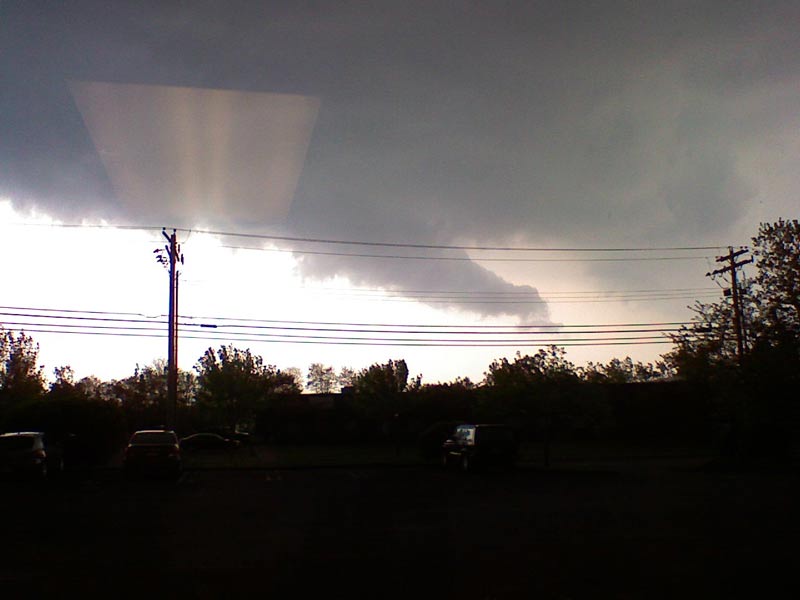
The “A” storm is usually pretty docile. Sort of like training wheels for weathermen. Except when they aren’t – Andrew, for instance.

Those were the ‘good old days.’ Back in 1992, Andrew didn’t form until mid-August. By August 16, 2005, we’d already seen Irene.

Blogger’s note: On the right side of the page, you’ll see links to the Hurricane Center’s official forecasts. Those are dynamic links which update through the season dozens of times a day.

Depressing Weather

Seven of the last eight days have had measurable rain. On the eight day, there was also rain – just not enough to statistically count.

Emotionally? That’s another story.

Instead of being a May of getting out, this has been a May of staying in. I am suffering from sensory deprivation.

I know – how can you feel sorry for me, in the most modern, convenient and advanced society ever known? You never heard the Pilgrims complain about burnout&#185.

Of course, many are currently suffering more than I can even fathom. Flooding in parts of Massachusetts and New Hampshire is at historic levels. Here in Connecticut there are pockets of minor to moderate flooding.

I still feel myself moping around. Maybe my temper is shorter than it should be.

By tomorrow some limited sunshine will appear. Will I bounce right back, or is the rain a convenient target on which to blame my bad mood?

&#185 – The concept of Pilgrim burnout is not mine. I wish I could remember who first used it.

China Makes Artificial Rain for Beijing

Chinese weather specialists used chemicals to engineer Beijing’s heaviest rainfall of the year, helping to relieve drought and rinse dust from China’s capital, the official Xinhua News Agency reported Friday. The Los Angeles Times relayed this story from China yesterday.

I’m not an expert in weather modification, but I know a little about it. Cloud seeding has been tried in the past and the results are usually less than desired.

Let me start at the essence – to see a cloud, you need a cloud. So, if you’re thinking of going to the Gobi and planting flowers, forget it.

You also need the proper temperature structure. Cloud seeding promotes the formation of ice crystals which, being too heavy to remain suspended in the cloud, fall to earth, melting on the way down. Voila – it’s rain.

I am worried that someone in China is selling a bill of goods to the government – making this seem more reliable than it really is. The fact that a single episode is squarely credited with record rainfall seems foolhardy at best and certainly non-scientific.

In science, when something happens without proper controls and protocols being in place, it’s called anecdotal evidence. It is interesting to look at, and probably spurs more study, but you can’t draw conclusions from anecdotes.

From the article, it looks like that’s just what they’ve done!

More important than the lack of rain is the terrible condition of Chinese air quality – the reason they needed this rain in the first place.

Judging by video I’ve seen, and first hand reports from friends and relatives who’ve visited, China’s air is not fit for breathing! City vistas are yellow with haze.

I just did a quick check on the weather in Beijing (not their most industrial city) and found a few hours yesterday when the reported weather condition was “smoke!”

We’re not perfect here, but many of the pollutants China is putting into the atmosphere have been brought under control in the states (many – not all, by any means). That means, probably for the cost savings, China has chosen not to use currently available technology.

I’m not a big worrier when it comes to human induced climate modification (aka – global warming), but if you are, what’s being done in Beijing should scare the daylights out of you. Whatever moisture falls from seeding is moisture unavailable for cloudiness (and rain) downstream.

There was once a commercial where the tag line was, “It’s not nice to fool Mother Nature.” Correct.